|
search place name
|
||
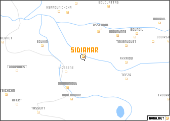
Sidi Amar (Beni Mellal, Morocco)Sidi Amar is a town in the Beni Mellal region of Morocco. An overview map of the region around Sidi Amar is displayed below.
regional and 3d topo map of Sidi Amar, Morocco ::
Sidi Amar airports ::
The nearest airport is ERH - Er-rachidia Moulay Ali Cherif, located 122.7 km east of Sidi Amar.
Other airports nearby include MEK - Meknes Bassatine (171.3 km north), FEZ - Fez Saiss (186.1 km north), OZZ - Ouarzazate (197.7 km south west), CMN - Casablanca Mohammed V Intl (217.3 km north west), Nearby towns ::
Terkelt (1.5km north) //
Ikassene (4.4km south west) //
Tadlount (6.9km north) //
Ouaourioud (6.8km south west) //
Assendal (7.6km north east) //
Ou Ali Ou Idir (8.9km south) //
Igourdane (8.2km north east) //
[all distances 'as the bird flies' and approximate] 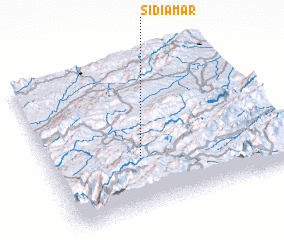 Places with similar names to Sidi Amar, Morocco ::
// Sudimiri (RU)
// Sidi Amar (MA)
// Sidi Amara (MA)
// Zhdimer (RU)
// Stomar (US)
// Seidmar (DE)
// Sottmar (DE)
// Stemmer (DE)
// Souto Maior (PT)
// Souto Maior (PT)
Disclaimer :: Information on this page comes without warranty of any kind |
||
|
Where is Sidi Amar? Elevation and coordinates ::
Latitude (lat): 32°20'13"N Longitude (lon): 5°36'55"W
Elevation (approx.): 1520m (map arrows pan, magnifying glasses zoom) |
||
|
Visiting Sidi Amar? Hotel/Accommodation ::
Book a hotel in Sidi Amar Travel Guide ::
Buy a travel guide for Morocco rental cars ::
car rental offers GPS waypoint ::
download a GPX waypoint (PoI) of Sidi Amar for your GPS receiver
|
||