|
search place name
|
||
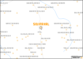
Sidi Rahal (El Jadida, Morocco)Sidi Rahal is a town in the El Jadida region of Morocco. An overview map of the region around Sidi Rahal is displayed below.
regional and 3d topo map of Sidi Rahal, Morocco ::
Sidi Rahal airports ::
The nearest airport is RAK - Marrakech Menara, located 103.8 km south of Sidi Rahal.
Other airports nearby include CMN - Casablanca Mohammed V Intl (120.5 km north east), OZZ - Ouarzazate (221.4 km south east), RBA - Rabat Sale (228.6 km north east), NNA - Kentira Kenitra (258.7 km north east), Nearby towns ::
Mtal (2.1km south) //
Douar Rechachda (2.4km north east) //
Douar el Hadda (3.6km north east) //
Oulad Mira (5.2km south) //
Sidi Abdallah el Haouaoui (5.6km south) //
El Haj el Hachmi (6.0km south west) //
Douar ech Chloua (7.6km north) //
Cheïkh Ben Soltana (7.6km south) //
Oulad Youssef (7.0km south west) //
El Orj (8.5km south west) //
[all distances 'as the bird flies' and approximate] 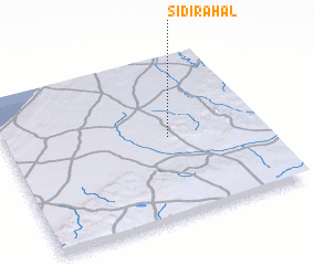 Places with similar names to Sidi Rahal, Morocco ::
// Cedar Hill (US)
// Cedar Hill (US)
// Star Hill (US)
// Sutter Hill (US)
// Star Hill (US)
// Cedar Hill (US)
// Cedar Hill (US)
// Cedarhill (US)
// Storheil (NO)
// Sátorhely (HU)
Disclaimer :: Information on this page comes without warranty of any kind |
||
|
Where is Sidi Rahal? Elevation and coordinates ::
Latitude (lat): 32°30'0"N Longitude (lon): 8°22'0"W
Elevation (approx.): 264m (map arrows pan, magnifying glasses zoom) |
||
|
Visiting Sidi Rahal? Hotel/Accommodation ::
Book a hotel in Sidi Rahal Travel Guide ::
Buy a travel guide for Morocco rental cars ::
car rental offers GPS waypoint ::
download a GPX waypoint (PoI) of Sidi Rahal for your GPS receiver
|
||