|
search place name
|
||
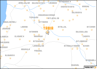
Tabia (Essaouira, Morocco)Tabia is a town in the Essaouira region of Morocco. An overview map of the region around Tabia is displayed below.
regional and 3d topo map of Tabia, Morocco ::
Tabia airports ::
The nearest airport is AGA - Agadir Inezgane, located 131.4 km south of Tabia.
Other airports nearby include RAK - Marrakech Menara (142.2 km east), CMN - Casablanca Mohammed V Intl (270.7 km north east), Nearby towns ::
Souk el Had du Drâa (1.4km north west) //
Azmanat (1.9km north) //
El Hemamda (2.4km south west) //
Oulad Mimoun (3.2km west) //
Aït Mbarek Ou Bella (3.7km south east) //
Aït Tahria (4.0km north west) //
Hammaïda (3.7km south west) //
Ounara (4.1km south west) //
Aït Sidi Saïd (4.9km south west) //
Aït Amara (4.7km west) //
Aït Lachleb (5.5km north) //
Aït Allal (5.1km east) //
Zaouia Sidi Kanoun (6.4km north) //
El Amarat (6.4km north west) //
Larbi Ou Jaa (6.4km south west) //
El Guelati (6.8km west) //
Tigmijjou (7.3km north west) //
Douar Azmata (7.3km north east) //
Faddoul (8.1km south west) //
Zegamena (8.7km north east) //
Bou Mkila (10.1km south west) //
[all distances 'as the bird flies' and approximate]  Places with similar names to Tabia, Morocco ::
Disclaimer :: Information on this page comes without warranty of any kind |
||
|
Where is Tabia? Elevation and coordinates ::
Latitude (lat): 31°34'0"N Longitude (lon): 9°32'0"W
Elevation (approx.): 206m (map arrows pan, magnifying glasses zoom) |
||
|
Visiting Tabia? Hotel/Accommodation ::
Book a hotel in Tabia Travel Guide ::
Buy a travel guide for Morocco rental cars ::
car rental offers GPS waypoint ::
download a GPX waypoint (PoI) of Tabia for your GPS receiver
|
||