|
search place name
|
||
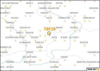
Tafza (Taza, Morocco)Tafza is a town in the Taza region of Morocco. An overview map of the region around Tafza is displayed below.
regional and 3d topo map of Tafza, Morocco ::
Tafza airports ::
The nearest airport is AHU - Al Hociema Cherif El Idrissi, located 60.8 km north east of Tafza.
Other airports nearby include FEZ - Fez Saiss (113.1 km south west), MLN - Melilla (129.6 km north east), TTU - Tetouan Saniat Rmel (141.0 km north west), MEK - Meknes Bassatine (152.6 km south west), Nearby towns ::
Dar el Haddad (1.5km west) //
Taïma (1.5km west) //
Maret (2.4km south east) //
Bouana (2.4km south west) //
Hinza (2.4km south east) //
Tafraout (3.0km west) //
Bouhia (3.6km north east) //
Oulad Bou Henina (3.6km north west) //
Toualza (4.8km south west) //
Dalia (5.6km north) //
Afress (4.9km west) //
Ifrane (4.9km east) //
Chihda (6.3km south west) //
Irhir Ahmed (7.4km north) //
Mokhfia (6.1km west) //
Tagrout (7.6km north) //
Ikherbachene (7.6km north) //
Rhar el Kaïs (7.2km north east) //
Taourirt (9.6km north west) //
Tahar Souk (9.6km south west) //
Tounes (9.6km south west) //
[all distances 'as the bird flies' and approximate] 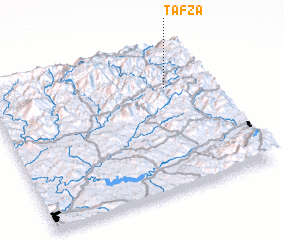 Places with similar names to Tafza, Morocco ::
Disclaimer :: Information on this page comes without warranty of any kind |
||
|
Where is Tafza? Elevation and coordinates ::
Latitude (lat): 34°43'0"N Longitude (lon): 4°12'0"W
Elevation (approx.): 916m (map arrows pan, magnifying glasses zoom) |
||
|
Visiting Tafza? Hotel/Accommodation ::
Book a hotel in Tafza Travel Guide ::
Buy a travel guide for Morocco rental cars ::
car rental offers GPS waypoint ::
download a GPX waypoint (PoI) of Tafza for your GPS receiver
|
||