|
search place name
|
||
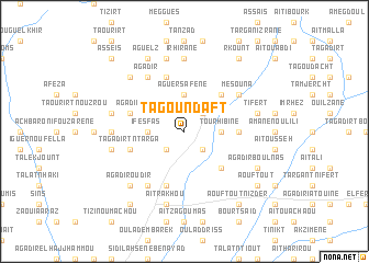
Tagoundaft (Taroudannt, Morocco)Tagoundaft is a town in the Taroudannt region of Morocco. An overview map of the region around Tagoundaft is displayed below.
regional and 3d topo map of Tagoundaft, Morocco ::
Tagoundaft airports ::
The nearest airport is RAK - Marrakech Menara, located 100.0 km north of Tagoundaft.
Other airports nearby include AGA - Agadir Inezgane (116.5 km west), OZZ - Ouarzazate (145.4 km east), Nearby towns ::
Aït Mehalla (2.4km south west) //
Aït Merri (2.4km north east) //
Metmour nʼAït Sidi Bouzid (2.4km south east) //
Ifesfas (3.2km west) //
Aguersafene (3.7km north) //
Tourhibine (3.2km east) //
Aït Hammou (3.2km east) //
Tafinegoult (3.2km east) //
Tachguelt (4.9km north east) //
Taberbourt (4.9km south east) //
Tassila (4.8km east) //
Sidi Abdallah Ou Moussa (5.8km south) //
Agadir (5.1km west) //
Imouzaz (5.8km north) //
Tagadirt nʼTarga (5.1km west) //
Oulad Fers (6.4km south west) //
Agadir (6.4km north west) //
Mesouna (6.0km north east) //
Taourirt nʼOuchbaro (6.4km west) //
Irhirane (7.4km north) //
Zaouia nʼIguerbeziz (6.6km west) //
Azrou (6.6km west) //
Aremd (7.6km north) //
Tagadirt (6.6km west) //
Aït Rakhou (7.6km south) //
Tifert (6.6km east) //
Agadir Oudir (7.3km south west) //
Oulad Krim (7.3km south west) //
Tanebdant (7.3km north west) //
[all distances 'as the bird flies' and approximate]  Places with similar names to Tagoundaft, Morocco ::
// Tagountaft (MA)
Disclaimer :: Information on this page comes without warranty of any kind |
||
|
Where is Tagoundaft? Elevation and coordinates ::
Latitude (lat): 30°46'0"N Longitude (lon): 8°25'0"W
Elevation (approx.): 757m (map arrows pan, magnifying glasses zoom) |
||
|
Visiting Tagoundaft? Hotel/Accommodation ::
Book a hotel in Tagoundaft Travel Guide ::
Buy a travel guide for Morocco rental cars ::
car rental offers GPS waypoint ::
download a GPX waypoint (PoI) of Tagoundaft for your GPS receiver
|
||