|
search place name
|
||
Tagragra (Essaouira, Morocco)Tagragra is a town in the Essaouira region of Morocco. An overview map of the region around Tagragra is displayed below.
regional and 3d topo map of Tagragra, Morocco ::

Tagragra airports ::
The nearest airport is AGA - Agadir Inezgane, located 105.6 km south of Tagragra.
Other airports nearby include RAK - Marrakech Menara (151.5 km east), Nearby towns ::
Dar Sidi Abd el Mjid (2.3km south east) //
Tisrharine (4.0km south west) //
Dar Caïd el Hajj Neknafi (5.2km south) //
Zaouit Ou Hassane (5.4km south east) //
Id Jaddi Mbark (6.5km north west) //
Id al Bacha (6.7km east) //
Aït el Aouni (7.5km north west) //
Taourirt (7.8km north east) //
Timessourine (8.9km south) //
Zaouia Moulay Lahsene (8.1km north east) //
El Krit (8.4km north east) //
[all distances 'as the bird flies' and approximate] 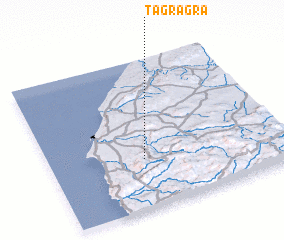 Places with similar names to Tagragra, Morocco ::
// Tagragra (MA)
// Tagragra (MA)
// Tiguirguira (NE)
// Tgarukiru (TZ)
// Dagarékourou (ML)
// Dougourakoro (ML)
// Dougourakoro (ML)
// Dougourakoro (ML)
// Tagragra (MA)
// Tagragra (MA)
Disclaimer :: Information on this page comes without warranty of any kind |
||
|
Where is Tagragra? Elevation and coordinates ::
Latitude (lat): 31°19'57"N Longitude (lon): 9°35'54"W
Elevation (approx.): 284m (map arrows pan, magnifying glasses zoom) |
||
|
Visiting Tagragra? Hotel/Accommodation ::
Book a hotel in Tagragra Travel Guide ::
Buy a travel guide for Morocco rental cars ::
car rental offers GPS waypoint ::
download a GPX waypoint (PoI) of Tagragra for your GPS receiver
|
||