|
search place name
|
||
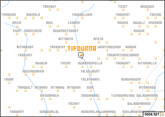
Tifourna (Taroudannt, Morocco)Tifourna is a town in the Taroudannt region of Morocco. An overview map of the region around Tifourna is displayed below.
regional and 3d topo map of Tifourna, Morocco ::
Tifourna airports ::
The nearest airport is AGA - Agadir Inezgane, located 103.2 km south west of Tifourna.
Other airports nearby include RAK - Marrakech Menara (106.0 km north east), OZZ - Ouarzazate (159.7 km east), Nearby towns ::
Ida Ou Blal (1.9km south) //
Iguer nʼOufella (2.4km south east) //
Achbaro nʼ Ifouzarene (3.2km east) //
Tarhouacht (3.7km north west) //
Tirzat (3.7km south west) //
Talekjount (4.0km south east) //
Aït Yahya (4.9km north west) //
Afeza (4.9km north east) //
Tizimert (4.8km east) //
Takoucht (5.1km west) //
Taourirt nʼOuzrou (5.1km east) //
Touggourht (5.1km east) //
Talat nʼHaki (5.8km south) //
Aguerd nʼ Tsoukt (6.4km north west) //
Toudma (6.0km north east) //
Abouziane (6.0km north east) //
Zaouia Tabgout (6.4km east) //
Igguia (6.6km west) //
Lkhoms (7.6km north) //
Aït Oumis (7.6km south) //
Sins (7.6km south) //
Tissel (8.8km north west) //
Aït Hamid (8.8km south west) //
Adki (9.8km north west) //
[all distances 'as the bird flies' and approximate]  Places with similar names to Tifourna, Morocco ::
// Tovarnyy (RU)
// Tvorino (RU)
// Tiferouine (MA)
// Tiferouine (MA)
// Tifrouine (MA)
// Taverne (CH)
// Däfern (DE)
// Doveren (DE)
// Tafern (DE)
// Täfern (DE)
Disclaimer :: Information on this page comes without warranty of any kind |
||
|
Where is Tifourna? Elevation and coordinates ::
Latitude (lat): 30°46'0"N Longitude (lon): 8°34'0"W
Elevation (approx.): 897m (map arrows pan, magnifying glasses zoom) |
||
|
Visiting Tifourna? Hotel/Accommodation ::
Book a hotel in Tifourna Travel Guide ::
Buy a travel guide for Morocco rental cars ::
car rental offers GPS waypoint ::
download a GPX waypoint (PoI) of Tifourna for your GPS receiver
|
||