|
search place name
|
||
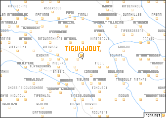
Tiguijjout (Agadir, Morocco)Tiguijjout is a town in the Agadir region of Morocco. An overview map of the region around Tiguijjout is displayed below.
regional and 3d topo map of Tiguijjout, Morocco ::
Tiguijjout airports ::
The nearest airport is AGA - Agadir Inezgane, located 59.4 km north west of Tiguijjout.
Other airports nearby include RAK - Marrakech Menara (194.0 km north east), Nearby towns ::
Aït Taleb (1.0km west) //
Taourirt (2.5km south west) //
Toug Rih (2.5km north west) //
Aguerdad (2.9km south west) //
Tamezzerbt (3.7km north) //
Aït Bou Nihi (3.2km west) //
Izrikene (4.0km south east) //
Tillil (3.7km south east) //
Tagaoussat (3.7km north east) //
Aït Ighil (4.5km north west) //
Imi nʼTazrout (4.9km north east) //
Bouagrizene (4.8km west) //
Ihankass (5.6km south) //
Tislane (5.6km south) //
Imi el Had Tasguedelt (5.0km west) //
Imi el Had (5.2km west) //
Zidat (5.8km south) //
Ikhadene (5.2km east) //
Saïssid (6.1km south west) //
Ifrhel (6.4km north east) //
Aït Amer (6.4km south east) //
Biougra (6.6km south west) //
Tourirt (6.4km east) //
Tifrit (6.4km west) //
Aït Bassa (6.7km west) //
Iferiadene (7.2km north west) //
Tazoult (7.4km south west) //
Iggui Aferd (6.9km west) //
Goulmane (7.4km south east) //
[all distances 'as the bird flies' and approximate] 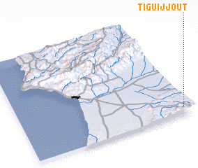 Places with similar names to Tiguijjout, Morocco ::
Disclaimer :: Information on this page comes without warranty of any kind |
||
|
Where is Tiguijjout? Elevation and coordinates ::
Latitude (lat): 30°5'0"N Longitude (lon): 9°2'0"W
Elevation (approx.): 867m (map arrows pan, magnifying glasses zoom) |
||
|
Visiting Tiguijjout? Hotel/Accommodation ::
Book a hotel in Tiguijjout Travel Guide ::
Buy a travel guide for Morocco rental cars ::
car rental offers GPS waypoint ::
download a GPX waypoint (PoI) of Tiguijjout for your GPS receiver
|
||