|
search place name
|
||
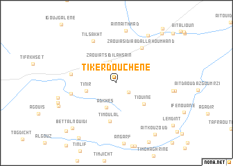
Tikerdouchene (Ouarzazate, Morocco)Tikerdouchene is a town in the Ouarzazate region of Morocco. An overview map of the region around Tikerdouchene is displayed below.
regional and 3d topo map of Tikerdouchene, Morocco ::
Tikerdouchene airports ::
The nearest airport is OZZ - Ouarzazate, located 69.1 km north east of Tikerdouchene.
Other airports nearby include RAK - Marrakech Menara (144.6 km north west), Nearby towns ::
Zaouiat Taliza (2.3km south east) //
Zaouiat Sidi Lahsaïn (3.6km north) //
Adkhes (4.2km south) //
Tinir (4.4km west) //
Tiouine (5.1km south east) //
Timoulal (6.3km south) //
Zaouia Sidi Abdallah Ou Mhand (6.6km north east) //
Kasbat Aït Mesri (6.5km west) //
Kourkda (6.5km west) //
Tilsakht (7.4km north west) //
Aïn nʼAït Hmad (8.5km north) //
Aïn Igourramene (8.8km north east) //
Bettal nʼOuidi (9.6km south west) //
Aït Kouzoud (9.9km south east) //
Dar Tanriouine (10.3km south west) //
Dar Ben Ider (10.1km north east) //
Bettal Aït Saïd (10.4km south west) //
Ifzouane (10.9km north east) //
[all distances 'as the bird flies' and approximate]  Places with similar names to Tikerdouchene, Morocco :: Disclaimer :: Information on this page comes without warranty of any kind |
||
|
Where is Tikerdouchene? Elevation and coordinates ::
Latitude (lat): 30°26'42"N Longitude (lon): 7°20'56"W
Elevation (approx.): 1548m (map arrows pan, magnifying glasses zoom) |
||
|
Visiting Tikerdouchene? Hotel/Accommodation ::
Book a hotel in Tikerdouchene Travel Guide ::
Buy a travel guide for Morocco rental cars ::
car rental offers GPS waypoint ::
download a GPX waypoint (PoI) of Tikerdouchene for your GPS receiver
|
||