|
search place name
|
||
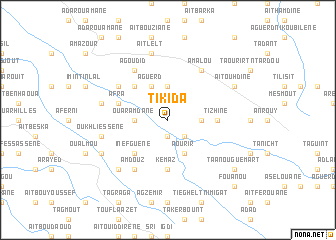
Tikida (Taroudannt, Morocco)Tikida is a town in the Taroudannt region of Morocco. An overview map of the region around Tikida is displayed below.
regional and 3d topo map of Tikida, Morocco ::
Tikida airports ::
The nearest airport is AGA - Agadir Inezgane, located 77.2 km west of Tikida.
Other airports nearby include RAK - Marrakech Menara (174.9 km north east), OZZ - Ouarzazate (199.1 km north east), Nearby towns ::
Tisemzal (1.9km south) //
Tafejgount (2.5km south east) //
Tinglif (3.7km north) //
Ouiniguider (3.2km east) //
Irhil Ismellalene (3.2km west) //
Ouaramdane (3.2km west) //
Aguerd (4.0km north west) //
Aourir (4.0km south east) //
Azdoud (4.9km north west) //
Inefguene (4.9km south west) //
Kemaz (5.6km south) //
Tizhine (4.8km east) //
Afra (5.2km west) //
Tinrerar (6.1km north west) //
Amalou (6.4km north east) //
Agoudid (6.4km north west) //
Amdouz (6.4km south west) //
Aït Lelt (7.6km north) //
Tanrhrat (7.6km north) //
Aguerd nʼ Tourirt (6.7km west) //
Oukhliessene (6.7km west) //
Iouzlit (7.4km south west) //
Aït Ouhdine (7.4km north east) //
Taïart (7.4km south west) //
Taanouguemart (8.5km south east) //
Fouanou (9.8km south east) //
[all distances 'as the bird flies' and approximate] 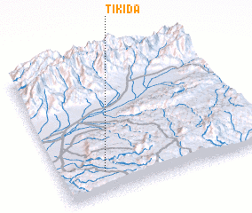 Places with similar names to Tikida, Morocco ::
Disclaimer :: Information on this page comes without warranty of any kind |
||
|
Where is Tikida? Elevation and coordinates ::
Latitude (lat): 30°10'0"N Longitude (lon): 8°47'0"W
Elevation (approx.): 1071m (map arrows pan, magnifying glasses zoom) |
||
|
Visiting Tikida? Hotel/Accommodation ::
Book a hotel in Tikida Travel Guide ::
Buy a travel guide for Morocco rental cars ::
car rental offers GPS waypoint ::
download a GPX waypoint (PoI) of Tikida for your GPS receiver
|
||