|
search place name
|
||
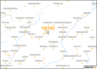
Tiktint (Taroudannt, Morocco)Tiktint is a town in the Taroudannt region of Morocco. An overview map of the region around Tiktint is displayed below.
regional and 3d topo map of Tiktint, Morocco ::
Tiktint airports ::
The nearest airport is AGA - Agadir Inezgane, located 46.8 km south west of Tiktint.
Other airports nearby include RAK - Marrakech Menara (152.1 km north east), Nearby towns ::
Tamzguert (1.6km west) //
Iousserane (1.7km west) //
Tasguint (2.0km north west) //
Tasguint (2.1km north west) //
Biramane (2.6km north) //
Tazarine (2.4km north east) //
Iggui nʼBlal (3.7km north) //
Sinit (4.0km north east) //
Imchirne (3.7km south west) //
Tassademt (4.0km south east) //
Aoujou (4.8km east) //
Bigoudine (5.1km east) //
Timdermit (5.8km south) //
Anemdel (5.8km south) //
Amegdoul (5.1km east) //
Tamzaourt (5.1km east) //
Tamlalt (5.6km west) //
Tamlalt (5.7km west) //
Agadir Imouzgaoun (6.0km north east) //
Tikki (7.4km north west) //
Tighoula (7.7km west) //
Imi Irhzer (8.5km north west) //
Tirkou (8.8km south east) //
Tizi el Hajaj (9.9km south west) //
[all distances 'as the bird flies' and approximate] 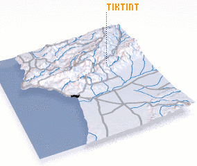 Places with similar names to Tiktint, Morocco ::
Disclaimer :: Information on this page comes without warranty of any kind |
||
|
Where is Tiktint? Elevation and coordinates ::
Latitude (lat): 30°43'0"N Longitude (lon): 9°15'0"W
Elevation (approx.): 864m (map arrows pan, magnifying glasses zoom) |
||
|
Visiting Tiktint? Hotel/Accommodation ::
Book a hotel in Tiktint Travel Guide ::
Buy a travel guide for Morocco rental cars ::
car rental offers GPS waypoint ::
download a GPX waypoint (PoI) of Tiktint for your GPS receiver
|
||