|
search place name
|
||
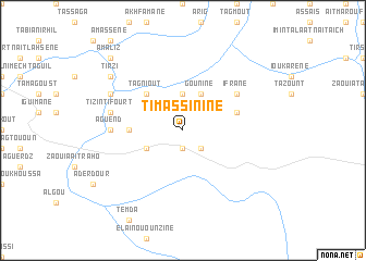
Timassinine (Taroudannt, Morocco)Timassinine is a town in the Taroudannt region of Morocco. An overview map of the region around Timassinine is displayed below.
regional and 3d topo map of Timassinine, Morocco ::
Timassinine airports ::
The nearest airport is OZZ - Ouarzazate, located 93.7 km north east of Timassinine.
Other airports nearby include RAK - Marrakech Menara (127.9 km north), AGA - Agadir Inezgane (174.5 km west), Nearby towns ::
Agoudas (1.9km south) //
Dougadir (1.9km south) //
Azergui (2.4km south east) //
Tafrent (3.7km north) //
Gounine (4.0km north east) //
Sidi Mohand Ou Embark (3.7km south west) //
Tagniout (4.9km north west) //
Zaouia Imrhid (4.8km west) //
Irherm (4.8km west) //
Argouni (5.1km east) //
Ifrane (6.1km north east) //
Tazoult (6.4km west) //
Aguend (6.4km west) //
Tizi nʼTifourt (6.7km west) //
Imiguern (7.4km north west) //
Tirzi (8.5km north west) //
Amaliz (9.8km north west) //
[all distances 'as the bird flies' and approximate] 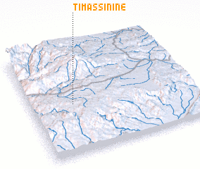 Places with similar names to Timassinine, Morocco ::
Disclaimer :: Information on this page comes without warranty of any kind |
||
|
Where is Timassinine? Elevation and coordinates ::
Latitude (lat): 30°29'0"N Longitude (lon): 7°44'0"W
Elevation (approx.): 1639m (map arrows pan, magnifying glasses zoom) |
||
|
Visiting Timassinine? Hotel/Accommodation ::
Book a hotel in Timassinine Travel Guide ::
Buy a travel guide for Morocco rental cars ::
car rental offers GPS waypoint ::
download a GPX waypoint (PoI) of Timassinine for your GPS receiver
|
||