|
search place name
|
||
Tinrheras (Er Rachidia, Morocco)Tinrheras is a town in the Er Rachidia region of Morocco. An overview map of the region around Tinrheras is displayed below.
regional and 3d topo map of Tinrheras, Morocco ::

Tinrheras airports ::
The nearest airport is ERH - Er-rachidia Moulay Ali Cherif, located 80.7 km north of Tinrheras.
Nearby towns ::
Metahra (1.0km south east) //
Oulad Jemia (1.1km north east) //
Chorft Ba Haj (1.4km north east) //
Gaouz (2.2km south) //
Bou Zmella (2.2km east) //
Oulad Ouilal (2.2km east) //
Zaouia Guirlane (2.9km north) //
Irara (2.7km east) //
Oulad Sidi Brahim Ben Halal (3.1km north) //
Tabouasamt (3.5km north east) //
Zaouia Sidi Ali Ben Abdallah (3.8km east) //
Kasba Guirlane (4.4km north east) //
Zaouia Remel (4.9km north) //
Zaouia el Cadi (4.7km north east) //
Zaouia Mellaïkhaf (5.3km east) //
Tazigzaout (5.3km east) //
Zaouia Sidi el Rhazi (5.4km east) //
Oulad Haddou (6.0km north east) //
Zaouia Sidi Ali Ben Bou Zina (6.7km north) //
Hamouda (6.0km north east) //
Graoua (6.0km north east) //
Oulad Saïdane (6.9km north) //
Megta Sfa (6.5km south west) //
Betorni (7.7km north) //
Moulay Abdallah Dekak (7.5km north east) //
Rissani (7.6km north east) //
Zaouia el Maati (6.8km east) //
Oulad Sidi Bou Brahim (6.9km east) //
Ammar (6.9km east) //
[all distances 'as the bird flies' and approximate] 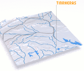 Places with similar names to Tinrheras, Morocco :: Disclaimer :: Information on this page comes without warranty of any kind |
||
|
Where is Tinrheras? Elevation and coordinates ::
Latitude (lat): 31°13'27"N Longitude (lon): 4°18'19"W
Elevation (approx.): 748m (map arrows pan, magnifying glasses zoom) |
||
|
Visiting Tinrheras? Hotel/Accommodation ::
Book a hotel in Tinrheras Travel Guide ::
Buy a travel guide for Morocco rental cars ::
car rental offers GPS waypoint ::
download a GPX waypoint (PoI) of Tinrheras for your GPS receiver
|
||