|
search place name
|
||
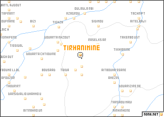
Tirhanimine (Taza, Morocco)Tirhanimine is a town in the Taza region of Morocco. An overview map of the region around Tirhanimine is displayed below.
regional and 3d topo map of Tirhanimine, Morocco ::
Tirhanimine airports ::
The nearest airport is FEZ - Fez Saiss, located 102.8 km west of Tirhanimine.
Other airports nearby include AHU - Al Hociema Cherif El Idrissi (141.7 km north), MEK - Meknes Bassatine (152.5 km west), MLN - Melilla (174.4 km north east), OUD - Oujda Angads (204.0 km north east), Nearby towns ::
Beni Damal (1.9km south) //
Meskhet (2.9km south west) //
Douar Ouled Driss (3.7km south) //
Ras el Ksar (4.3km north east) //
Taïda (4.8km south west) //
Imaïchene (4.8km south west) //
Tighza (5.1km north west) //
Tmarkemt (5.0km west) //
Douar Tarhzout (5.9km north west) //
Bou Saad (7.2km south west) //
Afzou (7.2km south west) //
Aït Bou Hassane (7.2km south east) //
Sidi Mou (8.0km north east) //
Tighza (8.4km north west) //
Amezri (8.3km south east) //
[all distances 'as the bird flies' and approximate] 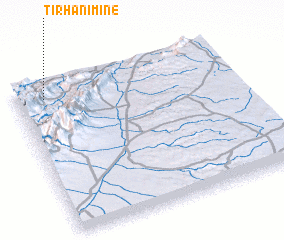 Places with similar names to Tirhanimine, Morocco ::
Disclaimer :: Information on this page comes without warranty of any kind |
||
|
Where is Tirhanimine? Elevation and coordinates ::
Latitude (lat): 33°54'0"N Longitude (lon): 3°52'0"W
Elevation (approx.): 1153m (map arrows pan, magnifying glasses zoom) |
||
|
Visiting Tirhanimine? Hotel/Accommodation ::
Book a hotel in Tirhanimine Travel Guide ::
Buy a travel guide for Morocco rental cars ::
car rental offers GPS waypoint ::
download a GPX waypoint (PoI) of Tirhanimine for your GPS receiver
|
||