|
search place name
|
||
Agayan (Leyte, Philippines)Agayan is a town in the Leyte region of Philippines. An overview map of the region around Agayan is displayed below.
regional and 3d topo map of Agayan, Philippines ::

Agayan airports ::
The nearest airport is TAC - Tacloban Daniel Z Romualdez, located 54.0 km east of Agayan.
Other airports nearby include NOP - Masbate Mactan Cebu Intl (117.4 km south west), BCD - Bacolod (186.5 km west), ILO - Iloilo (224.3 km west), DGT - Dumaguete (248.2 km south west), Nearby towns ::
Agay-ayan (0.0km north) //
Cabaluan (0.7km north) //
Maulayan (1.0km south west) //
Lubiranan (1.8km west) //
Tanguhay (2.4km south west) //
Luperia (2.6km east) //
Balagtas (2.7km south west) //
Homayhumay (3.9km south west) //
Lonog (3.8km east) //
Tonoy (4.1km east) //
Cabulan (4.4km north east) //
Kananga (4.4km south east) //
Catotocan (4.9km south east) //
Visares (5.0km north east) //
Maulayan (5.3km west) //
Boghaon (5.9km north west) //
Bayanacao (6.6km south west) //
Tolibao (6.6km north east) //
Rizal (6.7km south east) //
Katagbakan (6.9km north east) //
Libungan (7.5km south east) //
Kanawagan (7.5km south east) //
Cancanaan (7.8km south west) //
Bongbongan (7.8km north east) //
Bagbacay (7.8km north west) //
Dipi (7.9km south) //
Inambak (7.9km north east) //
Tabayho (8.1km north) //
Balanac (8.4km south west) //
[all distances 'as the bird flies' and approximate] 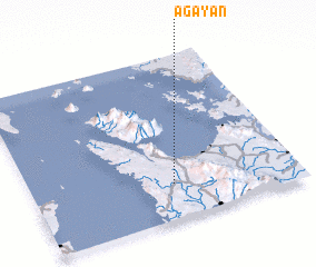 Places with similar names to Agayan, Philippines ::
Disclaimer :: Information on this page comes without warranty of any kind |
||
|
Where is Agayan? Elevation and coordinates ::
Latitude (lat): 11°13'0"N Longitude (lon): 124°32'0"E
Elevation (approx.): 30m (map arrows pan, magnifying glasses zoom) |
||
|
Visiting Agayan? Hotel/Accommodation ::
Book a hotel in Agayan Travel Guide ::
Buy a travel guide for Philippines rental cars ::
car rental offers GPS waypoint ::
download a GPX waypoint (PoI) of Agayan for your GPS receiver
|
||