|
search place name
|
||
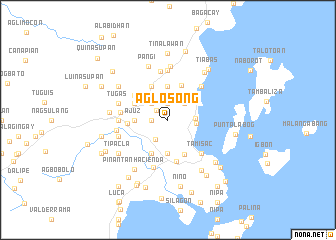
Aglosong (Iloilo, Philippines)Aglosong is a town in the Iloilo region of Philippines. An overview map of the region around Aglosong is displayed below.
regional and 3d topo map of Aglosong, Philippines ::
Aglosong airports ::
The nearest airport is BCD - Bacolod, located 68.8 km south of Aglosong.
Other airports nearby include ILO - Iloilo (82.3 km south west), KLO - Kalibo (89.1 km north west), SJI - San Jose Antique (134.9 km south west), NOP - Masbate Mactan Cebu Intl (144.3 km south east), Nearby towns ::
Tipolo (1.7km north west) //
Ambulong (1.9km north) //
Madarag (1.8km west) //
Santol (2.3km north) //
Aglahog (2.5km south west) //
Boroñgon (2.6km north east) //
Moto (2.6km north east) //
Mandu-awac (2.6km north east) //
Madanlog (2.6km north east) //
Sua (2.6km north east) //
Tamañgi (2.6km north east) //
San Nicolas (2.6km north east) //
Buhaybuhay (2.6km north west) //
Batuan (2.6km north west) //
Siempreviva (3.0km east) //
Nipa (3.2km east) //
Pase (3.7km north) //
Pagsangan (3.7km south) //
Belen (3.7km south) //
Alawihao (3.6km west) //
Anoring (3.6km west) //
Ajuz (3.6km west) //
Agsinapot (3.6km west) //
Aposaga (3.6km west) //
San Dionisio (3.7km north east) //
Bondolan (4.1km north) //
Calamigan (4.1km south west) //
Dugman (4.1km north west) //
Bairan (4.1km north west) //
[all distances 'as the bird flies' and approximate] 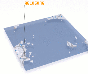 Places with similar names to Aglosong, Philippines ::
// Aglassing (AT)
Disclaimer :: Information on this page comes without warranty of any kind |
||
|
Where is Aglosong? Elevation and coordinates ::
Latitude (lat): 11°15'0"N Longitude (lon): 123°4'0"E
Elevation (approx.): 68m (map arrows pan, magnifying glasses zoom) |
||
|
Visiting Aglosong? Hotel/Accommodation ::
Book a hotel in Aglosong Travel Guide ::
Buy a travel guide for Philippines rental cars ::
car rental offers GPS waypoint ::
download a GPX waypoint (PoI) of Aglosong for your GPS receiver
|
||