|
search place name
|
||
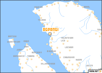
Agpangi (Leyte, Philippines)Agpangi is a town in the Leyte region of Philippines. An overview map of the region around Agpangi is displayed below.
regional and 3d topo map of Agpangi, Philippines ::
Agpangi airports ::
The nearest airport is TAC - Tacloban Daniel Z Romualdez, located 79.9 km south east of Agpangi.
Other airports nearby include NOP - Masbate Mactan Cebu Intl (149.2 km south), BCD - Bacolod (191.6 km south west), ILO - Iloilo (224.3 km south west), Nearby towns ::
Pangit (0.6km south east) //
Jamoraon (0.9km north) //
Anas (1.1km south east) //
Tamarindo (1.8km north east) //
Atipolo (2.1km south) //
Salangi (3.1km north west) //
Laka (3.2km south west) //
Almeria (3.5km north west) //
Naval (3.5km south) //
Caraycaray (4.7km south east) //
Aslom (4.7km south) //
Caukab (4.8km north) //
Ilihan (4.8km north) //
Pili (5.0km north west) //
Lico (5.2km south east) //
Talahib (5.9km north west) //
Talostosan (6.2km east) //
Inagusan (6.6km south) //
Campoding (6.7km south east) //
Bigaa (6.9km south) //
Tabunan (7.7km north west) //
Catmon (8.3km south east) //
Locsoon (8.4km south east) //
Buncogan (8.6km south west) //
Masagongsong (8.7km north west) //
Subancogon (8.8km south west) //
Ynalad (8.8km south west) //
Rabin (9.1km west) //
Villalon (9.3km south) //
[all distances 'as the bird flies' and approximate] 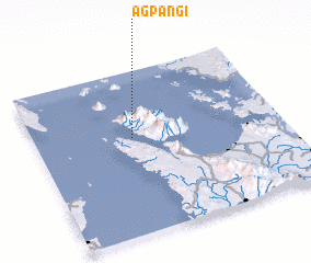 Places with similar names to Agpangi, Philippines ::
// Agponge (PH)
Disclaimer :: Information on this page comes without warranty of any kind |
||
|
Where is Agpangi? Elevation and coordinates ::
Latitude (lat): 11°35'32"N Longitude (lon): 124°23'46"E
Elevation (approx.): 3m (map arrows pan, magnifying glasses zoom) |
||
|
Visiting Agpangi? Hotel/Accommodation ::
Book a hotel in Agpangi Travel Guide ::
Buy a travel guide for Philippines rental cars ::
car rental offers GPS waypoint ::
download a GPX waypoint (PoI) of Agpangi for your GPS receiver
|
||