|
search place name
|
||
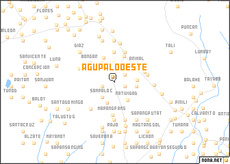
Agupalo Oeste (Nueva Ecija, Philippines)Agupalo Oeste is a town in the Nueva Ecija region of Philippines. An overview map of the region around Agupalo Oeste is displayed below.
regional and 3d topo map of Agupalo Oeste, Philippines ::
Agupalo Oeste airports ::
The nearest airport is BAG - Baguio, located 65.7 km north west of Agupalo Oeste.
Other airports nearby include MNL - Manila Ninoy Aquino Intl (148.0 km south), Nearby towns ::
Rizal (1.7km south east) //
Mapangpang (1.7km south east) //
Agupalo Este (2.0km north east) //
Alalay Grande (2.1km west) //
San Antonio Este (3.0km north) //
Sampaloc (3.2km south west) //
Salvacion Segunda (3.4km east) //
Burgos (3.6km south) //
Salvacion Primera (3.5km east) //
Natividad (3.6km south east) //
San Francisco (3.6km north west) //
San Antonio Oeste (4.3km north west) //
Fricos (4.3km north west) //
Lupao (4.4km north) //
Arimal (4.5km north east) //
Ambalingit (4.9km north) //
Bongar (4.8km north west) //
Parista (4.9km east) //
San Pedro (5.1km north) //
Namulandayan (5.1km north) //
Mapangpang (5.4km south) //
Carosalisan (5.3km east) //
Tuboy (5.3km east) //
Mañgandiñgay (5.8km south west) //
Baracbac (5.9km west) //
Vego (6.2km south) //
San Roque (6.4km north) //
Rizal (6.4km south) //
San Isidro (6.2km east) //
[all distances 'as the bird flies' and approximate]  Places with similar names to Agupalo Oeste, Philippines ::
// Agupalo Este (PH)
Disclaimer :: Information on this page comes without warranty of any kind |
||
|
Where is Agupalo Oeste? Elevation and coordinates ::
Latitude (lat): 15°50'22"N Longitude (lon): 120°53'7"E
Elevation (approx.): 95m (map arrows pan, magnifying glasses zoom) |
||
|
Visiting Agupalo Oeste? Hotel/Accommodation ::
Book a hotel in Agupalo Oeste Travel Guide ::
Buy a travel guide for Philippines rental cars ::
car rental offers GPS waypoint ::
download a GPX waypoint (PoI) of Agupalo Oeste for your GPS receiver
|
||