|
search place name
|
||
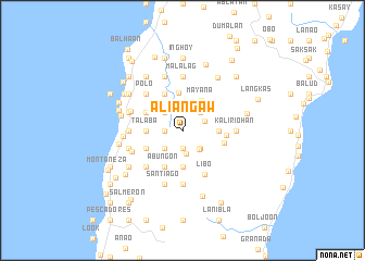
Aliangaw (Cebu, Philippines)Aliangaw is a town in the Cebu region of Philippines. An overview map of the region around Aliangaw is displayed below.
regional and 3d topo map of Aliangaw, Philippines ::
Aliangaw airports ::
The nearest airport is DGT - Dumaguete, located 43.7 km south of Aliangaw.
Other airports nearby include NOP - Masbate Mactan Cebu Intl (91.1 km north east), BCD - Bacolod (114.6 km north west), ILO - Iloilo (144.6 km north west), CGY - Ladag Cagayan De Oro (196.1 km south east), Nearby towns ::
Cagayan (1.9km south) //
Calut (1.8km west) //
Loguingot (1.8km west) //
Lepanto (2.4km south) //
Guadalupe (2.4km north east) //
Valencia (2.5km north) //
Trigup (2.6km south east) //
Campalad (2.6km north east) //
Cambinocot (2.6km north west) //
Colancojan (2.6km south east) //
Tunga (2.6km south west) //
Talayong (3.2km north west) //
Mayana (3.6km north east) //
Catulohan (3.7km east) //
Talaba (3.7km west) //
Palaypay (3.7km south) //
Tiguib (3.8km north) //
Sima (4.1km north west) //
Boyongan (4.1km north west) //
Cambogaong (4.1km south west) //
Lolumpan (4.1km south west) //
Abungon (4.1km south west) //
Juguiawan (4.1km south west) //
Nug-as (4.4km east) //
Cabugan (4.5km east) //
Libo (5.0km south east) //
Polo (5.2km north west) //
Canlayagon (5.2km south west) //
Lanaya (5.2km south west) //
[all distances 'as the bird flies' and approximate] 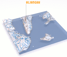 Places with similar names to Aliangaw, Philippines ::
Disclaimer :: Information on this page comes without warranty of any kind |
||
|
Where is Aliangaw? Elevation and coordinates ::
Latitude (lat): 9°43'0"N Longitude (lon): 123°24'0"E
Elevation (approx.): 716m (map arrows pan, magnifying glasses zoom) |
||
|
Visiting Aliangaw? Hotel/Accommodation ::
Book a hotel in Aliangaw Travel Guide ::
Buy a travel guide for Philippines rental cars ::
car rental offers GPS waypoint ::
download a GPX waypoint (PoI) of Aliangaw for your GPS receiver
|
||