|
search place name
|
||
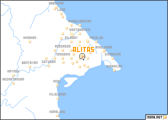
Alitas (Quezon, Philippines)Alitas is a town in the Quezon region of Philippines. An overview map of the region around Alitas is displayed below.
regional and 3d topo map of Alitas, Philippines ::
Alitas airports ::
The nearest airport is MNL - Manila Ninoy Aquino Intl, located 72.5 km west of Alitas.
Other airports nearby include BAG - Baguio (215.0 km north west), Nearby towns ::
Bacong (0.7km north) //
Kawagin (0.9km east) //
Langas (1.0km west) //
Binonoan (1.2km south) //
Anibong (1.6km west) //
Fabrica (1.7km south east) //
Pinaglukatan (1.8km south west) //
Maypulot (2.2km north east) //
Antikin (2.3km north) //
Tudturan (2.3km north) //
Cawayanin (2.3km north) //
Cumon (2.4km north west) //
Batikan (2.6km north west) //
Amoloñgin (2.6km west) //
Polo (2.8km west) //
Silañgan (3.0km north) //
Infanta (3.4km north) //
Banogao (3.5km north west) //
Misua (4.1km north) //
Abiawin (4.1km north) //
Libjo (4.1km north) //
Ingas (4.1km north) //
Iñgos (4.2km north) //
Balubo (4.2km north) //
Lual (4.2km north) //
Catambugan (4.2km north) //
Cawayan (4.2km north) //
Katambongan (4.2km north) //
Bantilan (4.3km north) //
[all distances 'as the bird flies' and approximate] 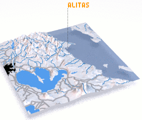 Places with similar names to Alitas, Philippines ::
Disclaimer :: Information on this page comes without warranty of any kind |
||
|
Where is Alitas? Elevation and coordinates ::
Latitude (lat): 14°42'49"N Longitude (lon): 121°39'32"E
Elevation (approx.): 6m (map arrows pan, magnifying glasses zoom) |
||
|
Visiting Alitas? Hotel/Accommodation ::
Book a hotel in Alitas Travel Guide ::
Buy a travel guide for Philippines rental cars ::
car rental offers GPS waypoint ::
download a GPX waypoint (PoI) of Alitas for your GPS receiver
|
||