|
search place name
|
||
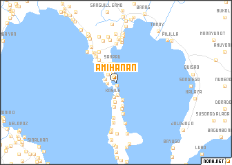
Amihanan (Rizal, Philippines)Amihanan is a town in the Rizal region of Philippines. An overview map of the region around Amihanan is displayed below.
regional and 3d topo map of Amihanan, Philippines ::
Amihanan airports ::
The nearest airport is MNL - Manila Ninoy Aquino Intl, located 24.1 km north west of Amihanan.
Other airports nearby include BAG - Baguio (225.7 km north), Nearby towns ::
Navotas (0.5km south) //
Pipindan (1.4km west) //
Nagsulo (1.5km north) //
Kalinawan (1.8km west) //
Ithan (1.8km north west) //
Subay (2.1km south) //
Kasile (2.5km south) //
Limbon-Limbon (2.9km north west) //
Calubacan (3.0km south) //
Sampad (3.1km north) //
Bombong (3.2km south) //
Bunot (3.2km north) //
Pila (3.7km north west) //
Kinagatan (3.9km south) //
Malamgam (4.0km south) //
Malanggam-Calubacan (4.4km south) //
Gupiing (4.5km north west) //
Gamutan (5.2km south) //
Lunsad (5.2km north west) //
Libid (5.6km north west) //
Tutulo (5.6km north west) //
San Guillermo (5.6km north west) //
Kinabogan (5.8km south) //
Binangonan (6.0km north west) //
Looc (6.3km north) //
Bangad (6.6km south) //
Dalig (6.6km north) //
Boor (6.8km south) //
Matikiw (6.7km north west) //
[all distances 'as the bird flies' and approximate] 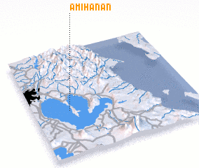 Places with similar names to Amihanan, Philippines :: Disclaimer :: Information on this page comes without warranty of any kind |
||
|
Where is Amihanan? Elevation and coordinates ::
Latitude (lat): 14°25'19"N Longitude (lon): 121°13'29"E
Elevation (approx.): 14m (map arrows pan, magnifying glasses zoom) |
||
|
Visiting Amihanan? Hotel/Accommodation ::
Book a hotel in Amihanan Travel Guide ::
Buy a travel guide for Philippines rental cars ::
car rental offers GPS waypoint ::
download a GPX waypoint (PoI) of Amihanan for your GPS receiver
|
||