|
search place name
|
||
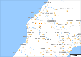
Anapog (Toledo, Philippines)Anapog is a town in the Toledo region of Philippines. An overview map of the region around Anapog is displayed below.
regional and 3d topo map of Anapog, Philippines ::
Anapog airports ::
The nearest airport is NOP - Masbate Mactan Cebu Intl, located 37.3 km east of Anapog.
Other airports nearby include BCD - Bacolod (85.9 km north west), DGT - Dumaguete (114.2 km south), ILO - Iloilo (127.8 km west), TAC - Tacloban Daniel Z Romualdez (182.7 km north east), Nearby towns ::
Bulungan (1.0km north west) //
Sam-ang (2.9km north east) //
Bulangan (3.2km south) //
Tanibag (3.3km north west) //
Hagakhakan (4.4km west) //
Media Once (4.7km north east) //
Cabiangon (4.7km west) //
Sibago (5.0km south) //
Cangmangque (5.0km south) //
Poog (4.9km east) //
Bunga (5.0km south) //
San Miguel (5.1km north west) //
Anislag (5.2km south west) //
Magdugo (5.7km north east) //
Bitoon (5.8km north west) //
Kambangog (5.8km north east) //
Lut-od (6.0km south) //
Ibo (6.0km north) //
Pandacan (5.9km south west) //
Tajao (5.9km west) //
Bato (6.0km north west) //
Awihao (6.3km north) //
Tubod (6.4km north) //
San Juan (6.8km north) //
Canlumampao (7.0km north east) //
Alpaco (7.1km south east) //
Cueva (7.3km south east) //
Pinamungahan (7.6km south west) //
Toledo (7.7km north) //
[all distances 'as the bird flies' and approximate]  Places with similar names to Anapog, Philippines ::
Disclaimer :: Information on this page comes without warranty of any kind |
||
|
Where is Anapog? Elevation and coordinates ::
Latitude (lat): 10°18'36"N Longitude (lon): 123°38'21"E
Elevation (approx.): 12m (map arrows pan, magnifying glasses zoom) |
||
|
Visiting Anapog? Hotel/Accommodation ::
Book a hotel in Anapog Travel Guide ::
Buy a travel guide for Philippines rental cars ::
car rental offers GPS waypoint ::
download a GPX waypoint (PoI) of Anapog for your GPS receiver
|
||