|
search place name
|
||
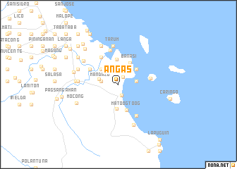
Añgas (Camarines Norte, Philippines)Añgas is a town in the Camarines Norte region of Philippines. An overview map of the region around Añgas is displayed below.
regional and 3d topo map of Añgas, Philippines ::
Nearby towns ::
Tambo (1.3km north east) //
Magisa (1.8km south) //
Manpinas (2.6km north) //
Mamboñgalon (2.6km north) //
Mambulao (2.6km north) //
Focan (2.7km west) //
Mandazo (2.7km west) //
Malagonot (2.7km west) //
Cayucyucan (2.8km east) //
Tacad (3.1km west) //
Catanduñganon (3.6km north west) //
Pinagtacdan (3.7km north east) //
Mancamagong (3.9km south) //
Banasi (3.9km north east) //
Tomandoc (3.9km north) //
Matoog-toog (4.3km south) //
Gaboc (5.0km north west) //
Manpili (5.0km north west) //
Quinapaguian (5.1km east) //
Mercedes (5.6km north) //
Ginipaan (5.7km south east) //
Tarum (6.2km north) //
Tanayagan (6.2km north) //
Hamoraon (6.2km north) //
Tagontong (6.2km north) //
Apwao (6.2km north) //
Pigwarasan (6.3km west) //
Plaridel (6.3km west) //
Titisan (6.3km west) //
[all distances 'as the bird flies' and approximate]  Places with similar names to Añgas, Philippines ::
Disclaimer :: Information on this page comes without warranty of any kind |
||
|
Where is Añgas? Elevation and coordinates ::
Latitude (lat): 14°3'42"N Longitude (lon): 123°1'28"E
Elevation (approx.): 14m (map arrows pan, magnifying glasses zoom) |
||
|
Visiting Añgas? Hotel/Accommodation ::
Book a hotel in Añgas Travel Guide ::
Buy a travel guide for Philippines rental cars ::
car rental offers GPS waypoint ::
download a GPX waypoint (PoI) of Añgas for your GPS receiver
|
||