|
search place name
|
||
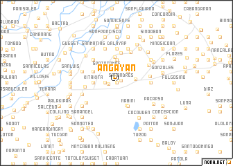
Añgayan (Pangasinan, Philippines)Añgayan is a town in the Pangasinan region of Philippines. An overview map of the region around Añgayan is displayed below.
regional and 3d topo map of Añgayan, Philippines ::
Añgayan airports ::
The nearest airport is BAG - Baguio, located 53.3 km north of Añgayan.
Other airports nearby include MNL - Manila Ninoy Aquino Intl (157.7 km south), Nearby towns ::
Rajal (0.0km north) //
San Andres (0.8km north east) //
Balungao (1.3km west) //
San Aurelio Primero (1.8km west) //
San Aurelio Segundo (1.8km west) //
Decreto (2.6km north east) //
Santo Tomas (2.7km north west) //
San Leon (3.0km east) //
San Joaquin (3.7km north) //
Kitakita (3.6km west) //
Esmeralda (4.0km south east) //
Mabini (4.1km south east) //
Capulaan (4.0km north west) //
San Raymundo (4.0km north west) //
San Julian (4.2km north) //
San Pablo (4.9km north) //
Balincanaway (4.9km west) //
Timmagpao (5.1km north west) //
San Marcelino (5.1km north west) //
Gallero (5.1km north west) //
San Miguel (5.1km north west) //
Santa Cruz (5.4km north east) //
San Isidro (5.3km east) //
La Paz (5.3km east) //
Resurreccion (5.3km east) //
Dalayap (5.6km north) //
Acop (5.7km south west) //
San Pedro (5.7km west) //
San Nicolas (5.7km west) //
[all distances 'as the bird flies' and approximate] 
Disclaimer :: Information on this page comes without warranty of any kind |
||
|
Where is Añgayan? Elevation and coordinates ::
Latitude (lat): 15°54'0"N Longitude (lon): 120°42'0"E
Elevation (approx.): 43m (map arrows pan, magnifying glasses zoom) |
||
|
Visiting Añgayan? Hotel/Accommodation ::
Book a hotel in Añgayan Travel Guide ::
Buy a travel guide for Philippines rental cars ::
car rental offers GPS waypoint ::
download a GPX waypoint (PoI) of Añgayan for your GPS receiver
|
||