|
search place name
|
||
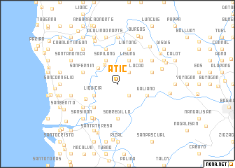
Atic (La Union, Philippines)Atic is a town in the La Union region of Philippines. An overview map of the region around Atic is displayed below.
regional and 3d topo map of Atic, Philippines ::
Atic airports ::
The nearest airport is BAG - Baguio, located 21.6 km south east of Atic.
Other airports nearby include MNL - Manila Ninoy Aquino Intl (223.8 km south), Nearby towns ::
Bitag (2.6km south east) //
Boulaolacao (2.6km north east) //
Balecbec Sur (3.6km north west) //
Magungunay (3.9km north west) //
Balecbec (4.1km north west) //
Sapilang (4.1km north west) //
Liquicia (4.0km south west) //
Lisung (4.1km north east) //
Angcaoay (4.1km north east) //
Galiano (4.9km east) //
Macabato (5.1km south west) //
Bayabas West (5.1km north east) //
Sobredillo (5.6km south) //
Bitag (5.6km south) //
San Jose (5.4km south west) //
Al-Alinao Sur (5.8km north) //
Basca (5.6km east) //
San Fermin (5.6km west) //
Libtong (5.8km north) //
Areno Sur (5.8km north) //
Areno Norte (5.8km north) //
San Juan (6.5km south west) //
Pidpid (6.6km south west) //
Bayabas (6.5km north east) //
Amica (6.5km north east) //
San Antonio (6.7km south west) //
Pappa (7.4km north) //
Bayyating (7.4km north) //
Ribsuan (7.4km north) //
[all distances 'as the bird flies' and approximate] 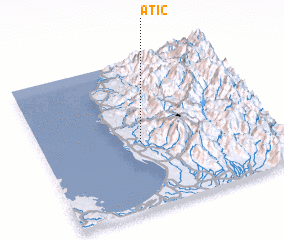 Places with similar names to Atic, Philippines ::
Disclaimer :: Information on this page comes without warranty of any kind |
||
|
Where is Atic? Elevation and coordinates ::
Latitude (lat): 16°27'0"N Longitude (lon): 120°26'0"E
Elevation (approx.): 163m (map arrows pan, magnifying glasses zoom) |
||
|
Visiting Atic? Hotel/Accommodation ::
Book a hotel in Atic Travel Guide ::
Buy a travel guide for Philippines rental cars ::
car rental offers GPS waypoint ::
download a GPX waypoint (PoI) of Atic for your GPS receiver
|
||