|
search place name
|
||
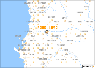
Babal-losa (La Union, Philippines)Babal-losa is a town in the La Union region of Philippines. An overview map of the region around Babal-losa is displayed below.
regional and 3d topo map of Babal-losa, Philippines ::
Babal-losa airports ::
The nearest airport is BAG - Baguio, located 39.9 km south east of Babal-losa.
Nearby towns ::
San Gabriel (1.0km north) //
Dasay (1.5km south east) //
Bucao (1.9km north) //
Bumbuneg (1.9km north) //
Dugadog (1.9km north) //
Capacoan (1.9km north) //
Duplas (1.8km east) //
Nadsaag (1.8km west) //
Laguan (1.8km west) //
Caarusipan (2.6km north west) //
Carusipan (2.6km north west) //
Bacsayan (2.6km north west) //
Cabogan (2.6km north west) //
Nagyubuyuban (2.6km south east) //
Pacpacac (2.6km south west) //
San Felipe (3.7km north) //
Catdungan (3.6km west) //
Pao Norte (3.7km south) //
Baraoas (3.7km south) //
Dangdangla (4.0km north west) //
Drissoor (4.0km south east) //
Tamugdug (4.1km south east) //
Capran (4.1km south east) //
Bagolig (4.1km south east) //
Nagyubuyuban (4.1km south east) //
Saracat (4.1km south west) //
Pagdildilan (4.1km south west) //
Lipay (4.7km north) //
Santa Rosa (4.9km north west) //
[all distances 'as the bird flies' and approximate] 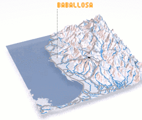 Places with similar names to Babal-losa, Philippines ::
Disclaimer :: Information on this page comes without warranty of any kind |
||
|
Where is Babal-losa? Elevation and coordinates ::
Latitude (lat): 16°40'0"N Longitude (lon): 120°24'0"E
Elevation (approx.): 15m (map arrows pan, magnifying glasses zoom) |
||
|
Visiting Babal-losa? Hotel/Accommodation ::
Book a hotel in Babal-losa Travel Guide ::
Buy a travel guide for Philippines rental cars ::
car rental offers GPS waypoint ::
download a GPX waypoint (PoI) of Babal-losa for your GPS receiver
|
||