|
search place name
|
||
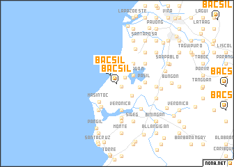
Bacsil (Ilocos Norte, Philippines)Bacsil is a town in the Ilocos Norte region of Philippines. An overview map of the region around Bacsil is displayed below.
regional and 3d topo map of Bacsil, Philippines ::
Bacsil airports ::
The nearest airport is BAG - Baguio, located 191.8 km south of Bacsil.
Nearby towns ::
Saoang (0.9km south east) //
Nagbacalan (1.5km north east) //
Bacsil (1.7km north west) //
Sungadan (2.8km north east) //
Baleygat (3.0km south east) //
Maglabacan (3.3km north) //
Baligo (3.5km east) //
Balatong (4.0km north east) //
Masintoc (4.1km south west) //
Surgui (4.3km south) //
Cayubog (4.3km south) //
Veronica (4.3km south) //
San Agustin (4.3km south) //
Nalboan (4.3km south) //
Paratong (4.3km south) //
Cabagoan (4.3km south) //
Pannaratan (4.3km south) //
San Blas (4.3km south) //
Dolores (4.3km south) //
Pambaran (4.3km south) //
Cabangaran (4.3km south) //
Pasil (4.3km east) //
Callaguip (4.5km south west) //
Salindeg (5.1km south west) //
Nang-guyudan (5.3km north east) //
Quiling (5.4km south east) //
Paoay (5.6km south) //
Panaratan (6.2km south) //
Calayab (6.2km north east) //
[all distances 'as the bird flies' and approximate] 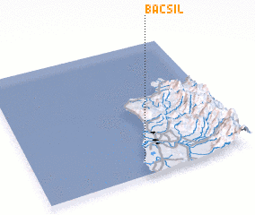 Places with similar names to Bacsil, Philippines ::
Disclaimer :: Information on this page comes without warranty of any kind |
||
|
Where is Bacsil? Elevation and coordinates ::
Latitude (lat): 18°6'18"N Longitude (lon): 120°30'35"E
Elevation (approx.): 29m (map arrows pan, magnifying glasses zoom) |
||
|
Visiting Bacsil? Hotel/Accommodation ::
Book a hotel in Bacsil Travel Guide ::
Buy a travel guide for Philippines rental cars ::
car rental offers GPS waypoint ::
download a GPX waypoint (PoI) of Bacsil for your GPS receiver
|
||