|
search place name
|
||
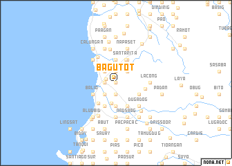
Bagutot (La Union, Philippines)Bagutot is a town in the La Union region of Philippines. An overview map of the region around Bagutot is displayed below.
regional and 3d topo map of Bagutot, Philippines ::
Bagutot airports ::
The nearest airport is BAG - Baguio, located 46.5 km south east of Bagutot.
Nearby towns ::
Burayoc (0.0km north) //
Zaragosa (0.0km north) //
Bacnotan (1.6km west) //
Agtipal (1.9km north) //
Cabugao (1.8km west) //
Casiaman (1.8km west) //
Quidem (1.9km south) //
Nangalisan (1.8km west) //
Nagsimbaanan (1.8km west) //
Dumarang (1.8km west) //
San Martin (1.8km west) //
Lisqueb (1.8km west) //
Uyaoy (1.8km west) //
Pangpang (1.8km west) //
Narra (1.8km west) //
Raois (1.8km west) //
Bacsil (1.8km west) //
Guinguinabang (1.9km south) //
Legleg (1.9km south) //
Sipulo (1.8km west) //
Nagsaraboan (1.8km west) //
Bussaoit (1.9km south) //
Bal-lugo (1.8km west) //
Nagatiran (1.8km west) //
Cabaroan (2.2km north) //
Sapilang (2.6km north east) //
Say-oan (2.6km north east) //
Salincob (2.6km north east) //
Pandan (2.6km north west) //
[all distances 'as the bird flies' and approximate]  Places with similar names to Bagutot, Philippines ::
Disclaimer :: Information on this page comes without warranty of any kind |
||
|
Where is Bagutot? Elevation and coordinates ::
Latitude (lat): 16°43'0"N Longitude (lon): 120°22'0"E
Elevation (approx.): 16m (map arrows pan, magnifying glasses zoom) |
||
|
Visiting Bagutot? Hotel/Accommodation ::
Book a hotel in Bagutot Travel Guide ::
Buy a travel guide for Philippines rental cars ::
car rental offers GPS waypoint ::
download a GPX waypoint (PoI) of Bagutot for your GPS receiver
|
||