|
search place name
|
||
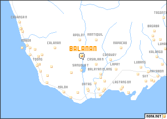
Balanan (Negros Oriental, Philippines)Balanan is a town in the Negros Oriental region of Philippines. An overview map of the region around Balanan is displayed below.
regional and 3d topo map of Balanan, Philippines ::
Balanan airports ::
The nearest airport is DGT - Dumaguete, located 38.0 km north east of Balanan.
Other airports nearby include LGP - Legazpi Pagadian (151.5 km south), NOP - Masbate Mactan Cebu Intl (167.5 km north east), BCD - Bacolod (168.0 km north), ILO - Iloilo (183.2 km north), Nearby towns ::
Sandolot (2.5km south) //
Casala-an (3.0km east) //
Caticugan (4.0km south west) //
Apoloy (4.5km north) //
Balayan Olang (5.0km south east) //
Mantiquil (5.3km north east) //
Tayac (5.6km south east) //
Camboay (5.9km south east) //
Canaway (6.0km east) //
Tubod (6.7km south east) //
Datag (6.7km south) //
Calañan (6.9km west) //
Siaton (7.1km south) //
Cahulad (7.3km west) //
Inalad (7.4km south east) //
Mantuyop (7.5km south) //
Lapay (7.5km east) //
Canaway (8.1km south east) //
Sumaliring (8.3km south east) //
Maloh (8.6km south west) //
Napacao (8.7km east) //
Balogo (8.8km south east) //
Tabong (8.8km south west) //
Nagba (9.0km south) //
Cabangahan (9.7km south west) //
Lagtangon (10.6km south east) //
Albiga (10.6km south east) //
Agbagacay (10.6km south east) //
[all distances 'as the bird flies' and approximate] 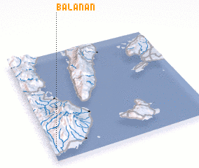 Places with similar names to Balanan, Philippines ::
// Baliuanan (PH)
// Baylanon (PH)
// Bolinauan (PH)
// Bulaanon (PH)
// Bulanon (PH)
// Belle Union (US)
// Białynin (PL)
// Bella Unión (CU)
// Bella Unión (CU)
// Balaniny (UA)
Disclaimer :: Information on this page comes without warranty of any kind |
||
|
Where is Balanan? Elevation and coordinates ::
Latitude (lat): 9°7'36"N Longitude (lon): 123°1'28"E
Elevation (approx.): 59m (map arrows pan, magnifying glasses zoom) |
||
|
Visiting Balanan? Hotel/Accommodation ::
Book a hotel in Balanan Travel Guide ::
Buy a travel guide for Philippines rental cars ::
car rental offers GPS waypoint ::
download a GPX waypoint (PoI) of Balanan for your GPS receiver
|
||