|
search place name
|
||
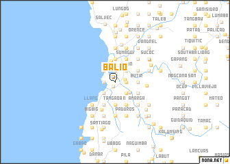
Balio (Abra, Philippines)Balio is a town in the Abra region of Philippines. An overview map of the region around Balio is displayed below.
regional and 3d topo map of Balio, Philippines ::
Balio airports ::
The nearest airport is BAG - Baguio, located 110.9 km south of Balio.
Nearby towns ::
Suso (0.8km south) //
Santa Maria (1.5km east) //
Tangaoan (1.8km east) //
Nagtupacan (1.9km north) //
Panar Sumagui (1.9km north) //
Danuman West (1.9km north) //
Nalvo (1.8km west) //
Biao (2.5km north) //
Tinaan (2.6km north east) //
Maynganay Sur (2.6km north east) //
Maynganay Norte (2.6km north east) //
Sabangan-Pingan (2.6km south east) //
Mambug Norte (2.6km south east) //
Lubong (2.6km south east) //
Lingsat (2.6km north west) //
Bengñgang (2.6km south west) //
Mambug (2.9km south east) //
San Pedro (3.4km north) //
Cabaroan (3.5km east) //
Butir (3.5km east) //
Nanguneg (3.7km north) //
Cappa-Cappa (3.7km south) //
Tangaoan (3.7km south) //
Laslasong West (4.0km north east) //
Sumagui (4.1km north east) //
Ampoagan (4.0km south east) //
Pacang (4.0km south east) //
Subadi (4.1km south east) //
Nueva Coveta (4.1km south east) //
[all distances 'as the bird flies' and approximate] 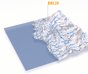 Places with similar names to Balio, Philippines ::
Disclaimer :: Information on this page comes without warranty of any kind |
||
|
Where is Balio? Elevation and coordinates ::
Latitude (lat): 17°22'0"N Longitude (lon): 120°28'0"E
Elevation (approx.): 5m (map arrows pan, magnifying glasses zoom) |
||
|
Visiting Balio? Hotel/Accommodation ::
Book a hotel in Balio Travel Guide ::
Buy a travel guide for Philippines rental cars ::
car rental offers GPS waypoint ::
download a GPX waypoint (PoI) of Balio for your GPS receiver
|
||