|
search place name
|
||
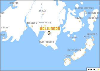
Baliungan (Tawi-Tawi, Philippines)Baliungan is a town in the Tawi-Tawi region of Philippines. An overview map of the region around Baliungan is displayed below.
regional and 3d topo map of Baliungan, Philippines ::
Baliungan airports ::
The nearest airport is LDU - Lahad Datu, located 208.5 km west of Baliungan.
Other airports nearby include ZAM - Zamboanga Intl (283.0 km north east), Nearby towns ::
Baldatal Islam (3.7km south) //
Pahahpatan (4.1km north west) //
Tandubas (7.5km north west) //
Dungun (8.6km north) //
Batu (9.3km west) //
Gusong (10.6km south east) //
Temang (11.2km south east) //
Sapa-Sapa (11.7km south east) //
[all distances 'as the bird flies' and approximate] 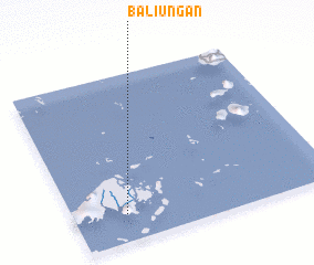 Places with similar names to Baliungan, Philippines ::
// Balanakan (PH)
// Balañgon (PH)
// Balanigan (PH)
// Balanacan (PH)
// Balanacan (PH)
// Balanacan (PH)
// Balangan (PH)
// Balinacon (PH)
// Balingaoan (PH)
// Balingaoan (PH)
Disclaimer :: Information on this page comes without warranty of any kind |
||
|
Where is Baliungan? Elevation and coordinates ::
Latitude (lat): 5°10'0"N Longitude (lon): 120°12'0"E
Elevation (approx.): 38m (map arrows pan, magnifying glasses zoom) |
||
|
Visiting Baliungan? Hotel/Accommodation ::
Book a hotel in Baliungan Travel Guide ::
Buy a travel guide for Philippines rental cars ::
car rental offers GPS waypoint ::
download a GPX waypoint (PoI) of Baliungan for your GPS receiver
|
||