|
search place name
|
||
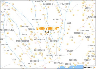
Banaybanay (Cavite, Philippines)Banaybanay is a town in the Cavite region of Philippines. An overview map of the region around Banaybanay is displayed below.
regional and 3d topo map of Banaybanay, Philippines ::
Banaybanay airports ::
The nearest airport is MNL - Manila Ninoy Aquino Intl, located 35.7 km north of Banaybanay.
Nearby towns ::
Halang (0.9km north west) //
Bababing (1.1km east) //
Boni (1.1km west) //
Dagatan (1.3km south) //
Litlit (1.4km east) //
Bucal (1.9km south) //
Pasong Kabayo (2.0km north west) //
Calubcob (2.3km east) //
Pañgil (2.6km west) //
Amadeo (3.2km south) //
Luksuhin (3.9km east) //
Alulud (4.0km west) //
Lalaan Primero (4.1km east) //
Bona Lejos (4.3km south west) //
Minantok (4.4km south east) //
San Juan (4.4km south west) //
Bona Cerca (4.7km west) //
Tambong Munting-Kulit (4.7km west) //
Balagbag Mahabang Kahoy (4.9km south) //
Maymanga (5.0km south) //
Kaytapus (5.1km west) //
Baliti Segundo (5.2km east) //
Cilibin (5.4km north) //
Talon (5.5km south) //
Loma (5.6km south) //
Indang (5.4km west) //
Biluso (5.7km north east) //
Kaykiwit (5.7km south west) //
Lalaan Segundo (6.0km south east) //
[all distances 'as the bird flies' and approximate]  Places with similar names to Banaybanay, Philippines ::
// Banaban (PH)
// Banaban (PH)
// Banaban (PH)
// Banay-Banay (PH)
// Banaybanay (PH)
// Banaybanay (PH)
// Banaybanay (PH)
// Banaybanay (PH)
// Banban (PH)
// Banban (PH)
Disclaimer :: Information on this page comes without warranty of any kind |
||
|
Where is Banaybanay? Elevation and coordinates ::
Latitude (lat): 14°11'57"N Longitude (lon): 120°55'37"E
Elevation (approx.): 354m (map arrows pan, magnifying glasses zoom) |
||
|
Visiting Banaybanay? Hotel/Accommodation ::
Book a hotel in Banaybanay Travel Guide ::
Buy a travel guide for Philippines rental cars ::
car rental offers GPS waypoint ::
download a GPX waypoint (PoI) of Banaybanay for your GPS receiver
|
||