|
search place name
|
||
Bangad (Isabela, Philippines)Bangad is a town in the Isabela region of Philippines. An overview map of the region around Bangad is displayed below.
regional and 3d topo map of Bangad, Philippines ::

Bangad airports ::
The nearest airport is BAG - Baguio, located 174.8 km south west of Bangad.
Nearby towns ::
San Isidro (0.9km north east) //
Calamagui (1.2km south west) //
Garalucod (2.5km south east) //
Cannagan (2.6km north) //
Lingaling (2.6km south west) //
Ballacayu (2.7km east) //
Auitan (2.8km south) //
Lattu (3.0km south) //
Divisoria (3.4km north) //
Binguang (3.5km south) //
San Pablo (3.5km south east) //
Santa Maria (4.1km south west) //
San Antonio (4.2km south west) //
San Rafael (4.2km south west) //
Minanga Norte (4.8km south) //
Lemu (5.0km north) //
Quinagabian (5.1km south west) //
Calamagui (5.3km south) //
Namabbalan (5.5km north) //
Mozzozzin (5.7km south west) //
Catabayungan (6.3km south) //
San Jose (6.4km north) //
Manga (6.7km south) //
Ugad (6.8km south) //
Angancasilian (6.8km south) //
Luquilu (6.8km south) //
Minanga Sur (6.8km south) //
Anao (6.8km south) //
Bubug (6.8km south) //
[all distances 'as the bird flies' and approximate] 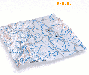 Places with similar names to Bangad, Philippines ::
Disclaimer :: Information on this page comes without warranty of any kind |
||
|
Where is Bangad? Elevation and coordinates ::
Latitude (lat): 17°29'36"N Longitude (lon): 121°46'43"E
Elevation (approx.): 30m (map arrows pan, magnifying glasses zoom) |
||
|
Visiting Bangad? Hotel/Accommodation ::
Book a hotel in Bangad Travel Guide ::
Buy a travel guide for Philippines rental cars ::
car rental offers GPS waypoint ::
download a GPX waypoint (PoI) of Bangad for your GPS receiver
|
||