|
search place name
|
||
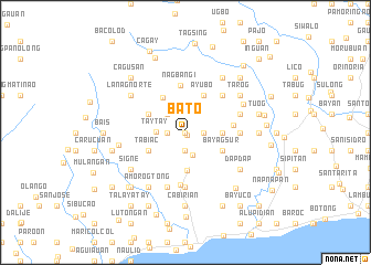
Bato (Iloilo, Philippines)Bato is a town in the Iloilo region of Philippines. An overview map of the region around Bato is displayed below.
regional and 3d topo map of Bato, Philippines ::
Bato airports ::
The nearest airport is ILO - Iloilo, located 25.7 km east of Bato.
Other airports nearby include SJI - San Jose Antique (41.9 km west), BCD - Bacolod (68.4 km east), KLO - Kalibo (101.2 km north), NOP - Masbate Mactan Cebu Intl (188.9 km east), Nearby towns ::
Nabillan (0.0km north) //
Morcillas (0.0km north) //
Talento (0.0km north) //
Bondoc (0.0km north) //
Daga-ay (0.0km north) //
Joná (0.0km north) //
Iñgay (0.0km north) //
Nagbá (0.0km north) //
Pinamacalan (0.0km north) //
Siñgon (0.0km north) //
Victoria (0.0km north) //
Mayang (0.0km north) //
Molina (0.0km north) //
Desposorio (0.0km north) //
Bagunanay (0.0km north) //
Lanag Sur (0.0km north) //
Tubungan (0.3km south east) //
Cananaman (1.8km east) //
Adgao (1.9km south) //
Balicua (1.9km south) //
Ambarihon (1.9km south) //
Buenavista (1.8km west) //
Ingay (2.4km south) //
Sibucauan (2.6km north west) //
Agó (2.6km north west) //
Male (2.6km north west) //
Cadabdab (2.6km north west) //
Jolason (2.8km north) //
Taytay (2.9km west) //
[all distances 'as the bird flies' and approximate] 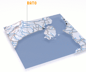 Places with similar names to Bato, Philippines ::
Disclaimer :: Information on this page comes without warranty of any kind |
||
|
Where is Bato? Elevation and coordinates ::
Latitude (lat): 10°46'0"N Longitude (lon): 122°19'0"E
Elevation (approx.): 97m (map arrows pan, magnifying glasses zoom) |
||
|
Visiting Bato? Hotel/Accommodation ::
Book a hotel in Bato Travel Guide ::
Buy a travel guide for Philippines rental cars ::
car rental offers GPS waypoint ::
download a GPX waypoint (PoI) of Bato for your GPS receiver
|
||