|
search place name
|
||
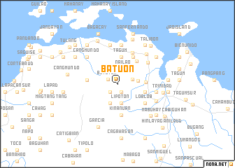
Batuon (Bohol, Philippines)Batuon is a town in the Bohol region of Philippines. An overview map of the region around Batuon is displayed below.
regional and 3d topo map of Batuon, Philippines ::
Batuon airports ::
The nearest airport is NOP - Masbate Mactan Cebu Intl, located 40.3 km north west of Batuon.
Other airports nearby include DGT - Dumaguete (136.3 km south west), TAC - Tacloban Daniel Z Romualdez (149.8 km north east), BCD - Bacolod (159.6 km north west), CGY - Ladag Cagayan De Oro (189.3 km south), Nearby towns ::
Buhian (1.4km south east) //
Bongbong (1.4km south east) //
Popo (1.4km south east) //
Butoyon (1.6km north west) //
Batoan (1.7km south west) //
Bigot (2.5km east) //
Nailao (2.6km north east) //
Lipoton (3.2km south) //
Auyan (3.3km east) //
Banlasan (3.3km south) //
Tagum (4.3km north) //
Mahagbu (4.5km east) //
San Roque (4.5km east) //
Tongo (4.7km north east) //
Bacsan (4.9km west) //
San Jose Sur (4.9km north east) //
Kinanuan (5.0km south) //
Loblob (5.3km south east) //
San Jose (5.5km north east) //
Baboy (5.9km north east) //
Panagboan (6.2km north) //
Cangbukag (6.3km north) //
Ipil (6.2km east) //
Bayongan (6.2km east) //
Bugang (6.2km east) //
Cangmundo (6.5km north west) //
San Isidro (6.6km north east) //
Buyog (6.7km south east) //
Badyang (7.3km south east) //
[all distances 'as the bird flies' and approximate] 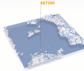 Places with similar names to Batuon, Philippines ::
Disclaimer :: Information on this page comes without warranty of any kind |
||
|
Where is Batuon? Elevation and coordinates ::
Latitude (lat): 10°5'41"N Longitude (lon): 124°16'39"E
Elevation (approx.): 33m (map arrows pan, magnifying glasses zoom) |
||
|
Visiting Batuon? Hotel/Accommodation ::
Book a hotel in Batuon Travel Guide ::
Buy a travel guide for Philippines rental cars ::
car rental offers GPS waypoint ::
download a GPX waypoint (PoI) of Batuon for your GPS receiver
|
||