|
search place name
|
||
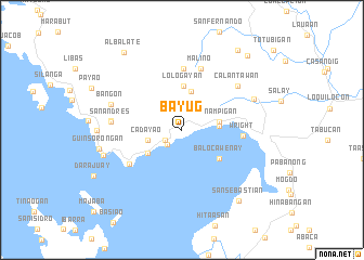
Bayug (Samar, Philippines)Bayug is a town in the Samar region of Philippines. An overview map of the region around Bayug is displayed below.
regional and 3d topo map of Bayug, Philippines ::
Bayug airports ::
The nearest airport is TAC - Tacloban Daniel Z Romualdez, located 61.1 km south of Bayug.
Other airports nearby include NOP - Masbate Mactan Cebu Intl (194.9 km south west), Nearby towns ::
Malobago (2.0km south west) //
Bogho (2.0km south west) //
Magcabitan (2.0km south west) //
Dogongan (2.0km south west) //
Casapa (2.0km south west) //
Jiabong (2.1km south west) //
Cadayao (3.6km west) //
Motiong (3.8km east) //
Hinicaan (3.9km east) //
Sinampigan (3.9km east) //
Camoroboan (4.1km north) //
Jia-an (4.2km south west) //
Lologayan (4.5km north) //
Balocawenay (4.8km south east) //
Wright (6.2km east) //
Gabong (6.4km north) //
Pangdan (6.4km south west) //
Malino (6.7km north) //
Calantawan (7.2km north east) //
San Andres (7.2km west) //
Nasonogan (7.2km west) //
Bangon (7.6km west) //
Inalad (7.9km north east) //
Bono-anan (8.3km west) //
Guinsorongan (8.6km west) //
Catbalogan (8.6km west) //
San Sebastian (9.3km south east) //
Albalate (9.9km north west) //
Maybahay (9.9km north east) //
[all distances 'as the bird flies' and approximate]  Places with similar names to Bayug, Philippines ::
Disclaimer :: Information on this page comes without warranty of any kind |
||
|
Where is Bayug? Elevation and coordinates ::
Latitude (lat): 11°46'34"N Longitude (lon): 124°57'55"E
Elevation (approx.): 25m (map arrows pan, magnifying glasses zoom) |
||
|
Visiting Bayug? Hotel/Accommodation ::
Book a hotel in Bayug Travel Guide ::
Buy a travel guide for Philippines rental cars ::
car rental offers GPS waypoint ::
download a GPX waypoint (PoI) of Bayug for your GPS receiver
|
||