|
search place name
|
||
Bigo (Quezon, Philippines)Bigo is a town in the Quezon region of Philippines. An overview map of the region around Bigo is displayed below.
regional and 3d topo map of Bigo, Philippines ::

Bigo airports ::
The nearest airport is MNL - Manila Ninoy Aquino Intl, located 89.6 km north west of Bigo.
Nearby towns ::
Bukal (1.3km east) //
Banyata (1.3km east) //
Mate (1.6km north west) //
Pandakake (2.2km west) //
Viena (3.1km east) //
Ikirin (3.8km south east) //
Mapag-ong (3.8km south east) //
Tucalan (3.8km south east) //
Bantigue (3.8km south east) //
Pinagbayanan (3.8km south east) //
Bagumbuñgan Ibaba (3.8km south east) //
Bagumbuñgan Ilaya (3.8km south east) //
Tongko (4.0km west) //
Pagbilao (4.2km east) //
Ilayang Dupay (4.3km south) //
Yaugin (4.9km east) //
Gulang-gulang (5.5km south west) //
Ibabang Dupay (5.7km south west) //
Camp Wilhelm (5.9km south west) //
Canlurang Mayao (6.0km south) //
Mayao (6.2km south) //
Alsam (6.6km north west) //
Talipan (6.8km south east) //
Palsabañgon Ibaba (6.7km east) //
Mateuna (6.8km north west) //
Palsabangan (6.7km east) //
Valencia (7.0km north) //
Silangan Palale (7.0km north) //
Kanluran Palale (7.0km north) //
[all distances 'as the bird flies' and approximate] 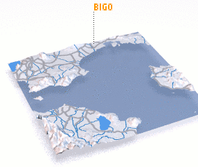 Places with similar names to Bigo, Philippines ::
Disclaimer :: Information on this page comes without warranty of any kind |
||
|
Where is Bigo? Elevation and coordinates ::
Latitude (lat): 13°59'15"N Longitude (lon): 121°39'18"E
Elevation (approx.): 103m (map arrows pan, magnifying glasses zoom) |
||
|
Visiting Bigo? Hotel/Accommodation ::
Book a hotel in Bigo Travel Guide ::
Buy a travel guide for Philippines rental cars ::
car rental offers GPS waypoint ::
download a GPX waypoint (PoI) of Bigo for your GPS receiver
|
||