|
search place name
|
||
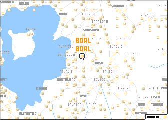
Boal (Lipa, Philippines)Boal is a town in the Lipa region of Philippines. An overview map of the region around Boal is displayed below.
regional and 3d topo map of Boal, Philippines ::
Boal airports ::
The nearest airport is MNL - Manila Ninoy Aquino Intl, located 59.1 km north of Boal.
Nearby towns ::
Nangkaan (1.8km west) //
Caliñgatan (1.9km south) //
Boal (1.9km north) //
San Sebastian (1.8km west) //
Baboyan (1.8km west) //
Santo Toribio (1.9km east) //
Bayorbor (2.3km west) //
Mataasnakahoy (2.6km south) //
Tañgob (2.6km south east) //
Santol (2.6km south west) //
Malabanan (2.6km north east) //
Kinalaglagan (2.6km north west) //
Bulacanin (2.7km east) //
Lumang Lipa (3.4km west) //
Upa (3.7km south) //
Paliparan (3.6km west) //
Mahabang Parang (3.6km west) //
Tanguay (3.8km south east) //
Magtago (3.9km north east) //
Pusil (4.0km south east) //
Balentiouac (4.0km south east) //
Looc (4.1km south west) //
Patipuran (4.1km south west) //
Calicangan (4.0km north east) //
San Andres (4.0km north east) //
Callagan (4.0km north west) //
Plaridel (4.0km north west) //
Habiñgan (4.0km north west) //
Inaclagan (4.0km north west) //
[all distances 'as the bird flies' and approximate] 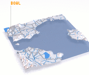 Places with similar names to Boal, Philippines ::
Disclaimer :: Information on this page comes without warranty of any kind |
||
|
Where is Boal? Elevation and coordinates ::
Latitude (lat): 13°59'0"N Longitude (lon): 121°7'0"E
Elevation (approx.): 279m (map arrows pan, magnifying glasses zoom) |
||
|
Visiting Boal? Hotel/Accommodation ::
Book a hotel in Boal Travel Guide ::
Buy a travel guide for Philippines rental cars ::
car rental offers GPS waypoint ::
download a GPX waypoint (PoI) of Boal for your GPS receiver
|
||