|
search place name
|
||
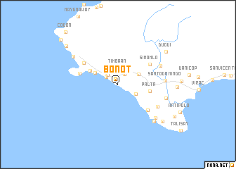
Bonot (Catanduanes, Philippines)Bonot is a town in the Catanduanes region of Philippines. An overview map of the region around Bonot is displayed below.
regional and 3d topo map of Bonot, Philippines ::
Bonot airports ::
The nearest airport is KLO - Kalibo, located 283.2 km south west of Bonot.
Nearby towns ::
Lictin (2.0km north east) //
Calolbon (2.1km north west) //
Rizal (2.2km north west) //
Tominauog (2.2km north west) //
Batong-Palouay (2.2km north west) //
San Andres (2.2km north west) //
Yocti (2.2km north west) //
Timbaan (2.6km north) //
Caragñag (2.7km north) //
Palauig (3.2km south east) //
San Jose (3.6km north east) //
Alibuag (3.9km north west) //
Comagaycay (4.8km north west) //
Palta (5.0km east) //
Simamla (5.8km north east) //
Balite (6.1km south east) //
Agojo (6.2km west) //
Catagbacan (6.2km north west) //
Hawan (7.1km south east) //
Buyo (7.2km north east) //
Santo Domingo (7.3km east) //
Sagrada-Familia (7.7km east) //
Marilima (7.9km south east) //
Maylililla (8.1km south east) //
Cabcab (8.1km north west) //
Magnesia (9.0km south east) //
Dugui (9.0km north east) //
Bislig (10.1km north west) //
Codon (11.6km north west) //
[all distances 'as the bird flies' and approximate] 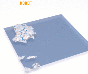 Places with similar names to Bonot, Philippines ::
Disclaimer :: Information on this page comes without warranty of any kind |
||
|
Where is Bonot? Elevation and coordinates ::
Latitude (lat): 13°35'11"N Longitude (lon): 124°6'54"E
Elevation (approx.): 4m (map arrows pan, magnifying glasses zoom) |
||
|
Visiting Bonot? Hotel/Accommodation ::
Book a hotel in Bonot Travel Guide ::
Buy a travel guide for Philippines rental cars ::
car rental offers GPS waypoint ::
download a GPX waypoint (PoI) of Bonot for your GPS receiver
|
||