|
search place name
|
||
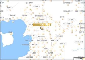
Bungcalot (Batangas, Philippines)Bungcalot is a town in the Batangas region of Philippines. An overview map of the region around Bungcalot is displayed below.
regional and 3d topo map of Bungcalot, Philippines ::
Bungcalot airports ::
The nearest airport is MNL - Manila Ninoy Aquino Intl, located 52.2 km north of Bungcalot.
Nearby towns ::
Banjo (0.5km north east) //
Tinurik (1.8km north west) //
Bulihan (1.8km south) //
San Isidro (1.9km south) //
Bungkalot (1.9km north) //
San Pedro (1.8km east) //
Bagongbayan (2.6km north west) //
Bituca (2.6km south west) //
San Pioquinto (2.6km north east) //
Malvar (2.8km east) //
Daraza (3.1km north east) //
Luta (3.6km south east) //
Sambat (3.7km north) //
Bagbag (3.6km west) //
San Juan (3.8km south) //
Magtago (3.9km south) //
Tanauan (4.1km north east) //
Natatas (4.1km north west) //
San Fernando (4.1km south east) //
Balele (4.5km west) //
Santiago (4.8km south east) //
Balete (5.1km south west) //
Janopol (5.2km north west) //
Payapa (5.2km south east) //
Trapiche (5.5km north) //
Santor (5.5km north west) //
San Isidro Sur (5.4km east) //
San Roque (5.6km north) //
San Fernando (5.6km north) //
[all distances 'as the bird flies' and approximate] 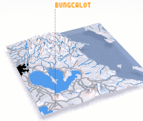 Places with similar names to Bungcalot, Philippines ::
Disclaimer :: Information on this page comes without warranty of any kind |
||
|
Where is Bungcalot? Elevation and coordinates ::
Latitude (lat): 14°3'0"N Longitude (lon): 121°8'0"E
Elevation (approx.): 183m (map arrows pan, magnifying glasses zoom) |
||
|
Visiting Bungcalot? Hotel/Accommodation ::
Book a hotel in Bungcalot Travel Guide ::
Buy a travel guide for Philippines rental cars ::
car rental offers GPS waypoint ::
download a GPX waypoint (PoI) of Bungcalot for your GPS receiver
|
||