|
search place name
|
||
Burabud (Leyte, Philippines)Burabud is a town in the Leyte region of Philippines. An overview map of the region around Burabud is displayed below.
regional and 3d topo map of Burabud, Philippines ::

Burabud airports ::
The nearest airport is TAC - Tacloban Daniel Z Romualdez, located 70.6 km east of Burabud.
Other airports nearby include NOP - Masbate Mactan Cebu Intl (116.6 km south), BCD - Bacolod (174.0 km south west), ILO - Iloilo (210.5 km west), DGT - Dumaguete (246.1 km south west), Nearby towns ::
Otabon (1.1km north east) //
Tibayla (1.9km south) //
Jinagnatan (1.9km south) //
Sonlagon (1.8km east) //
Lioliog (1.9km north west) //
Masisi (2.2km north) //
Kampokpok (2.5km north east) //
Bagakay (2.6km north west) //
Larey (2.9km south east) //
Tabango (3.0km north west) //
Tipulo (3.6km east) //
Tihagong (4.1km south) //
Maria Cristina (4.1km north west) //
Caiboy (4.1km north west) //
Canalimis (4.1km north west) //
Layog (4.1km north east) //
Kabayugan (4.1km north east) //
Baranbang (4.8km east) //
Tengbo (4.9km north east) //
Kabilisan (5.2km north west) //
Maigang (5.2km north west) //
Ginabuyan (5.5km south east) //
Umaganhan (5.8km north) //
Pinarut (6.6km south east) //
Boho (6.6km north west) //
Bagabao (6.6km east) //
Magupi (6.7km north west) //
Silad (6.9km south) //
Malcampo (7.1km north west) //
[all distances 'as the bird flies' and approximate] 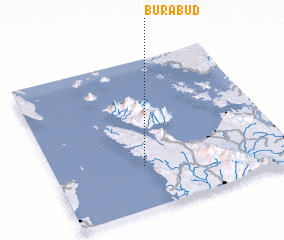 Places with similar names to Burabud, Philippines ::
Disclaimer :: Information on this page comes without warranty of any kind |
||
|
Where is Burabud? Elevation and coordinates ::
Latitude (lat): 11°17'0"N Longitude (lon): 124°23'0"E
Elevation (approx.): 4m (map arrows pan, magnifying glasses zoom) |
||
|
Visiting Burabud? Hotel/Accommodation ::
Book a hotel in Burabud Travel Guide ::
Buy a travel guide for Philippines rental cars ::
car rental offers GPS waypoint ::
download a GPX waypoint (PoI) of Burabud for your GPS receiver
|
||