|
search place name
|
||
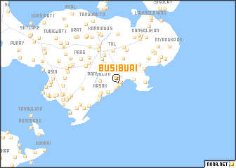
Busi Buai (Sulu, Philippines)Busi Buai is a town in the Sulu region of Philippines. An overview map of the region around Busi Buai is displayed below.
regional and 3d topo map of Busi Buai, Philippines ::
Busi Buai airports ::
The nearest airport is ZAM - Zamboanga Intl, located 137.1 km north east of Busi Buai.
Nearby towns ::
Kuta Sihi (0.3km south east) //
Sukuban (0.6km north east) //
Gimbaon (0.7km south) //
Kaloang (2.0km south west) //
Bagsak (2.5km north east) //
Lianutan (2.6km north) //
Kalang (2.6km east) //
Pansulon (2.9km west) //
Silat (3.0km north) //
Masok (3.0km south west) //
Timbayan (3.4km south west) //
Lumbaan (3.9km north west) //
Pitogo (4.0km south west) //
Bakuud (4.2km north) //
Mangas (4.2km east) //
Libung (4.6km north east) //
Kanbual (4.7km north west) //
Bunay (4.8km north east) //
Bantang (5.2km north west) //
Tiil (5.4km north) //
Mangal Mangal (5.6km north west) //
Tangkuan (5.6km north) //
Limbuaya (5.6km west) //
Kanpagaya (5.8km north west) //
Bandahala (5.8km south west) //
Cepe (5.9km north) //
Niog Niog (6.1km north west) //
Lingan (6.2km north west) //
Howit-Howit (6.3km north east) //
[all distances 'as the bird flies' and approximate] 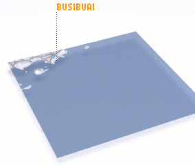 Places with similar names to Busi Buai, Philippines ::
Disclaimer :: Information on this page comes without warranty of any kind |
||
|
Where is Busi Buai? Elevation and coordinates ::
Latitude (lat): 5°54'46"N Longitude (lon): 121°20'26"E
Elevation (approx.): 60m (map arrows pan, magnifying glasses zoom) |
||
|
Visiting Busi Buai? Hotel/Accommodation ::
Book a hotel in Busi Buai Travel Guide ::
Buy a travel guide for Philippines rental cars ::
car rental offers GPS waypoint ::
download a GPX waypoint (PoI) of Busi Buai for your GPS receiver
|
||