|
search place name
|
||
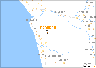
Cadmang (Zambales, Philippines)Cadmang is a town in the Zambales region of Philippines. An overview map of the region around Cadmang is displayed below.
regional and 3d topo map of Cadmang, Philippines ::
Cadmang airports ::
The nearest airport is MNL - Manila Ninoy Aquino Intl, located 127.3 km south east of Cadmang.
Other airports nearby include BAG - Baguio (142.7 km north east), Nearby towns ::
Apo-apo (3.0km south west) //
San Rafael (3.4km west) //
Santa Rita (3.6km south west) //
Talincawa (3.7km south) //
Mabanglit (4.3km west) //
San Isidro (4.4km south west) //
Cabangan (4.8km south) //
Panan (4.7km west) //
Santo Niño (5.7km south west) //
Camaliñgao (6.0km south west) //
San Juan (6.0km south west) //
Loñgos (7.0km south) //
Binuclutan (7.6km north west) //
Camiing (7.7km south) //
Zaragoza (7.7km south) //
Malomboy (8.8km north east) //
Biangue (9.9km north east) //
Cuagao (11.1km north west) //
[all distances 'as the bird flies' and approximate] 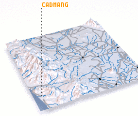 Places with similar names to Cadmang, Philippines ::
// Cadmang (PH)
// Gotthaming (AT)
// Koutamongou (BJ)
// Katumanga (CD)
// Katumanga (CD)
// Kotomanga (CD)
// Kay Doumanga (CG)
// Kattaming (UZ)
// Kitomanga (TZ)
Disclaimer :: Information on this page comes without warranty of any kind |
||
|
Where is Cadmang? Elevation and coordinates ::
Latitude (lat): 15°11'57"N Longitude (lon): 120°4'23"E
Elevation (approx.): 24m (map arrows pan, magnifying glasses zoom) |
||
|
Visiting Cadmang? Hotel/Accommodation ::
Book a hotel in Cadmang Travel Guide ::
Buy a travel guide for Philippines rental cars ::
car rental offers GPS waypoint ::
download a GPX waypoint (PoI) of Cadmang for your GPS receiver
|
||