|
search place name
|
||
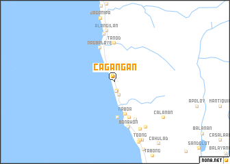
Cagangan (Negros Oriental, Philippines)Cagangan is a town in the Negros Oriental region of Philippines. An overview map of the region around Cagangan is displayed below.
regional and 3d topo map of Cagangan, Philippines ::
Cagangan airports ::
The nearest airport is DGT - Dumaguete, located 46.8 km east of Cagangan.
Other airports nearby include BCD - Bacolod (159.3 km north), LGP - Legazpi Pagadian (164.2 km south), NOP - Masbate Mactan Cebu Intl (170.5 km north east), ILO - Iloilo (171.4 km north), Nearby towns ::
Maloconan (1.5km south) //
Manalongon (1.5km south) //
San Francisco (2.3km south) //
Naboa (5.5km south) //
Tambo (5.9km south) //
Sawang (5.9km south) //
Nagbalaye (6.1km north west) //
Licolico (6.3km south) //
Tanod (6.3km north) //
Naponao (7.0km south east) //
Bonawon (7.7km south) //
Panasajan (8.0km north) //
Alangilan (8.5km north) //
Mangapo (8.7km south east) //
Itag Malaopad (8.8km south east) //
Calañan (9.7km south east) //
[all distances 'as the bird flies' and approximate] 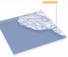 Places with similar names to Cagangan, Philippines ::
// Caigañgan (PH)
// Caigangan (PH)
// Kagangon (PH)
// Kākani Kona (BD)
// Kāknīkona (BD)
// Kogonoguen (BF)
// Kacangan (ID)
// Kagungan (ID)
// Kakangani (KE)
// Kigongoni (TZ)
Disclaimer :: Information on this page comes without warranty of any kind |
||
|
Where is Cagangan? Elevation and coordinates ::
Latitude (lat): 9°12'9"N Longitude (lon): 122°53'45"E
Elevation (approx.): 145m (map arrows pan, magnifying glasses zoom) |
||
|
Visiting Cagangan? Hotel/Accommodation ::
Book a hotel in Cagangan Travel Guide ::
Buy a travel guide for Philippines rental cars ::
car rental offers GPS waypoint ::
download a GPX waypoint (PoI) of Cagangan for your GPS receiver
|
||