|
search place name
|
||
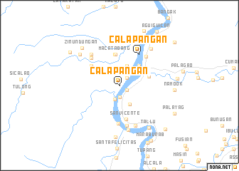
Calapangan (Cagayan, Philippines)Calapangan is a town in the Cagayan region of Philippines. An overview map of the region around Calapangan is displayed below.
regional and 3d topo map of Calapangan, Philippines ::
Calapangan airports ::
The nearest airport is BAG - Baguio, located 210.4 km south west of Calapangan.
Nearby towns ::
Guising (1.3km south east) //
Aggunetan (1.6km north east) //
Lapogan (1.7km south) //
Nabariongan (2.3km south) //
Aggunatan (3.2km south east) //
Cataraoan (3.2km north) //
Binago (3.8km north east) //
Nabbacayan (4.2km north east) //
Lomismo (4.5km east) //
Macatabang (5.0km north) //
Lasam (5.0km north) //
Alannay (5.2km north west) //
San Vicente (5.4km south) //
Calapangan (5.7km north east) //
Balagan (5.9km south) //
Gattaran (6.0km north east) //
Bactalan (6.1km north west) //
Caccag (6.3km south) //
Mesa (6.5km north west) //
Nassaping (6.6km south) //
Dungao (7.1km south) //
Casicallan (7.5km north east) //
Tubungan (7.7km north west) //
Tallu (7.9km south east) //
Abarriongan (8.1km south) //
Zinundungan (8.1km north west) //
Namook (8.2km east) //
Finugu (9.3km north east) //
Nabannagan (9.1km north west) //
[all distances 'as the bird flies' and approximate] 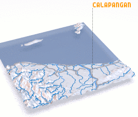 Places with similar names to Calapangan, Philippines ::
// Calapangan (PH)
Disclaimer :: Information on this page comes without warranty of any kind |
||
|
Where is Calapangan? Elevation and coordinates ::
Latitude (lat): 18°1'21"N Longitude (lon): 121°36'23"E
Elevation (approx.): 7m (map arrows pan, magnifying glasses zoom) |
||
|
Visiting Calapangan? Hotel/Accommodation ::
Book a hotel in Calapangan Travel Guide ::
Buy a travel guide for Philippines rental cars ::
car rental offers GPS waypoint ::
download a GPX waypoint (PoI) of Calapangan for your GPS receiver
|
||