|
search place name
|
||
Calioaquio (Ilocos Sur, Philippines)Calioaquio is a town in the Ilocos Sur region of Philippines. An overview map of the region around Calioaquio is displayed below.
regional and 3d topo map of Calioaquio, Philippines ::

Calioaquio airports ::
The nearest airport is BAG - Baguio, located 86.1 km south of Calioaquio.
Nearby towns ::
Collong (0.0km north) //
Madarang (0.0km north) //
Salcedo (1.2km north west) //
Baluarte (1.8km west) //
Atabay (1.8km west) //
San Gaspar (1.8km west) //
Balidbid (1.8km west) //
Baybayading (1.8km west) //
Buguibog (1.8km west) //
Lucbuben (2.6km south west) //
Ampayao (2.6km north east) //
Sorioan (3.2km south) //
Candelaria (3.8km north west) //
Pias (3.8km south west) //
Dinaraton (4.9km south west) //
Arangin-Dinaratan (5.1km south west) //
Gilong (5.1km north west) //
Vitong (5.2km north west) //
Kenmarin (5.6km south) //
Manga (5.6km north) //
San Pedro de Bulbuluacan (5.6km west) //
Bul-bul-luacan (5.6km west) //
Matue (5.6km east) //
Dapdappig (5.6km east) //
Botarag (5.6km east) //
Bossot (5.6km east) //
Allangigan Segundo (5.6km west) //
Allangigan Primero (5.6km west) //
Santo Rosario (5.8km south) //
[all distances 'as the bird flies' and approximate] 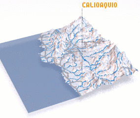 Places with similar names to Calioaquio, Philippines ::
Disclaimer :: Information on this page comes without warranty of any kind |
||
|
Where is Calioaquio? Elevation and coordinates ::
Latitude (lat): 17°9'0"N Longitude (lon): 120°33'0"E
Elevation (approx.): 119m (map arrows pan, magnifying glasses zoom) |
||
|
Visiting Calioaquio? Hotel/Accommodation ::
Book a hotel in Calioaquio Travel Guide ::
Buy a travel guide for Philippines rental cars ::
car rental offers GPS waypoint ::
download a GPX waypoint (PoI) of Calioaquio for your GPS receiver
|
||