|
search place name
|
||
Calo (Batangas, Philippines)Calo is a town in the Batangas region of Philippines. An overview map of the region around Calo is displayed below.
regional and 3d topo map of Calo, Philippines ::

Calo airports ::
The nearest airport is MNL - Manila Ninoy Aquino Intl, located 51.2 km north of Calo.
Nearby towns ::
Caylaway (2.1km north west) //
Balibaguhan (2.3km south east) //
Upli (2.8km east) //
Kaytitinga (3.1km north) //
Sinaliw Munti (3.7km north) //
Aga (4.0km north west) //
Luksuhin (4.9km east) //
Bilog (5.0km north) //
Mangas (5.0km north east) //
Matagbak (5.6km north) //
Marahan (5.8km north) //
Esperanza (5.9km north east) //
Anuling (6.1km north east) //
Alfonso (6.9km north) //
Tabla (6.9km south east) //
Cagayuan (6.8km east) //
Medina (7.3km north west) //
Palocpoc (7.5km north east) //
Pajo (7.6km north) //
Mayasang (7.6km south) //
Carasuchi (7.6km north east) //
Galicias (7.6km east) //
Narvaez (8.2km north) //
Guyam (8.4km north) //
Suplang (8.4km east) //
Tulay (8.5km north west) //
Panungyan (8.7km north east) //
Castaños (9.0km north) //
Mendez-Nuñez (9.0km north east) //
[all distances 'as the bird flies' and approximate] 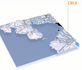 Places with similar names to Calo, Philippines ::
Disclaimer :: Information on this page comes without warranty of any kind |
||
|
Where is Calo? Elevation and coordinates ::
Latitude (lat): 14°4'50"N Longitude (lon): 120°50'20"E
Elevation (approx.): 531m (map arrows pan, magnifying glasses zoom) |
||
|
Visiting Calo? Hotel/Accommodation ::
Book a hotel in Calo Travel Guide ::
Buy a travel guide for Philippines rental cars ::
car rental offers GPS waypoint ::
download a GPX waypoint (PoI) of Calo for your GPS receiver
|
||