|
search place name
|
||
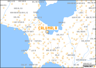
Calumala (Batangas, Philippines)Calumala is a town in the Batangas region of Philippines. An overview map of the region around Calumala is displayed below.
regional and 3d topo map of Calumala, Philippines ::
Calumala airports ::
The nearest airport is MNL - Manila Ninoy Aquino Intl, located 69.3 km north of Calumala.
Nearby towns ::
Bihis (1.7km west) //
Sinipian (1.8km west) //
Sambat (1.9km south) //
Santa Teresita (1.9km south) //
Tambo (1.9km north west) //
Bolboc (2.4km west) //
Pacifico (2.6km south west) //
Cubamba (2.6km north west) //
Cultihan (2.6km north west) //
Cutangcawayan (2.6km south east) //
Saimsim (2.7km north) //
Alitagtag (3.1km south east) //
Mozon (3.3km south) //
Sampa (3.5km south west) //
Buli (3.4km west) //
Mojon Segundo (3.7km south) //
Calampan (3.8km north west) //
San Martin (4.1km south west) //
Carsuche (4.0km north west) //
Maabud (4.1km north west) //
Hipit (4.1km north west) //
Bancoro (4.1km north west) //
Mulauin (4.0km south east) //
Balibag (4.7km south east) //
Calumpang (4.8km south) //
Luntal (4.8km north west) //
Dalipit (4.9km east) //
Abelo (5.0km north west) //
Balagbag (5.0km south east) //
[all distances 'as the bird flies' and approximate] 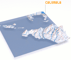 Places with similar names to Calumala, Philippines ::
// Kahlemeile (DE)
// Koloa Mill (US)
// Külmla (DE)
// Colmeal (PT)
// Colmeal (PT)
// Colmeal (PT)
// Colmeal (PT)
// Colmeal (PT)
// Golumbelu (RO)
// Çalımlı (TR)
Disclaimer :: Information on this page comes without warranty of any kind |
||
|
Where is Calumala? Elevation and coordinates ::
Latitude (lat): 13°53'0"N Longitude (lon): 120°59'0"E
Elevation (approx.): 57m (map arrows pan, magnifying glasses zoom) |
||
|
Visiting Calumala? Hotel/Accommodation ::
Book a hotel in Calumala Travel Guide ::
Buy a travel guide for Philippines rental cars ::
car rental offers GPS waypoint ::
download a GPX waypoint (PoI) of Calumala for your GPS receiver
|
||