|
search place name
|
||
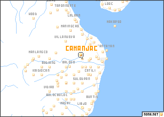
Camanjac (Dumaguete, Philippines)Camanjac is a town in the Dumaguete region of Philippines. An overview map of the region around Camanjac is displayed below.
regional and 3d topo map of Camanjac, Philippines ::
Camanjac airports ::
The nearest airport is DGT - Dumaguete, located 4.2 km north east of Camanjac.
Other airports nearby include NOP - Masbate Mactan Cebu Intl (134.6 km north east), BCD - Bacolod (151.2 km north), LGP - Legazpi Pagadian (166.1 km south), ILO - Iloilo (173.5 km north west), Nearby towns ::
Palinpinon (0.0km north) //
Candaoay (1.6km east) //
Taclobo (1.8km east) //
Bantinguil (1.8km east) //
Motong (1.8km east) //
Talay (1.9km south) //
Batinguil (2.0km south east) //
Junob (2.6km south east) //
Valencia (3.0km south) //
Bolocboloc (3.1km north east) //
Daro (3.2km east) //
Balogo (3.3km south west) //
Laguna (3.7km east) //
Mojon (3.7km east) //
San Antonio (3.7km north west) //
Cantil-i (3.8km south) //
Tubtuban (3.8km north east) //
Tabuctubig (4.1km south east) //
Canal (4.1km south east) //
Candauay (4.1km south east) //
Bajungpandan (4.1km south east) //
Calindagan (4.1km south east) //
Looc (4.1km south east) //
Cadauinonan (4.1km south east) //
Bagacay (4.1km south east) //
Buñao (4.1km south east) //
Angatan (4.1km south east) //
Catili (4.1km south east) //
Balabag (4.1km south west) //
[all distances 'as the bird flies' and approximate]  Places with similar names to Camanjac, Philippines ::
Disclaimer :: Information on this page comes without warranty of any kind |
||
|
Where is Camanjac? Elevation and coordinates ::
Latitude (lat): 9°19'0"N Longitude (lon): 123°16'0"E
Elevation (approx.): 54m (map arrows pan, magnifying glasses zoom) |
||
|
Visiting Camanjac? Hotel/Accommodation ::
Book a hotel in Camanjac Travel Guide ::
Buy a travel guide for Philippines rental cars ::
car rental offers GPS waypoint ::
download a GPX waypoint (PoI) of Camanjac for your GPS receiver
|
||