|
search place name
|
||
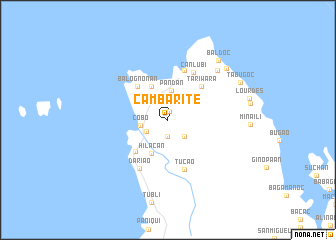
Cambarite (Catanduanes, Philippines)Cambarite is a town in the Catanduanes region of Philippines. An overview map of the region around Cambarite is displayed below.
regional and 3d topo map of Cambarite, Philippines ::
Nearby towns ::
Gusagunanan (0.9km north) //
Oga (1.9km south) //
Panuto (1.9km south) //
Guiamlong (1.9km south) //
Candao (1.9km south) //
Cantanban (1.9km south) //
Palongpong (1.9km south) //
Bagawang (2.1km north) //
Pogsagnahan (2.6km south east) //
Camboro (2.6km south west) //
Cobo (3.0km west) //
Pandan (3.3km north) //
Mangbang (4.1km north west) //
Hilacan (4.1km south west) //
Balogñonan (4.9km north west) //
Caramoran (5.0km south west) //
Tariwara (5.2km north east) //
Anlubi (5.8km north) //
Tucao (5.8km south) //
Canlubi (6.0km north east) //
Dariao (6.3km south west) //
Ati (7.7km north east) //
Marambong (8.5km north east) //
Baldoc (8.6km north east) //
Tabugoc (8.9km north east) //
[all distances 'as the bird flies' and approximate] 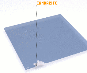 Places with similar names to Cambarite, Philippines ::
Disclaimer :: Information on this page comes without warranty of any kind |
||
|
Where is Cambarite? Elevation and coordinates ::
Latitude (lat): 14°1'0"N Longitude (lon): 124°10'0"E
Elevation (approx.): 43m (map arrows pan, magnifying glasses zoom) |
||
|
Visiting Cambarite? Hotel/Accommodation ::
Book a hotel in Cambarite Travel Guide ::
Buy a travel guide for Philippines rental cars ::
car rental offers GPS waypoint ::
download a GPX waypoint (PoI) of Cambarite for your GPS receiver
|
||